Maps
Browse through maps depicting Bay health and restoration, including pollution trends, public access sites and more.
Congressional Districts in the Chesapeake Bay Watershed (118th Congress)
Date created: May 2, 2023This map shows the complete or partial Congressional Districts that make up the area of the Chesapeake Bay basin. The current senators and congressional members of the 118th Congress who have districts within the borders of the basin are listed by state.
View map
2014 Public Access
Date created: April 28, 2015Existing public access sites in the Chesapeake Bay watershed as reported by state partners through 2014. Sites added in 2014 are depicted in orange, while sites existing before 2014 are blue.
View map
2013 Public Access
Date created: June 9, 2014Existing public access sites in the Chesapeake Bay watershed as reported by state partners through 2013. Sites added in 2013 are depicted in orange, while sites existing before 2013 are blue.
View map
2012 Public Access
Date created: May 16, 2013Existing public access sites in the Chesapeake Bay watershed as reported by state partners through 2012. Sites added in 2012 are depicted in orange, while sites existing before 2011 are blue.
View map
Public Access Sites 2011
Date created: November 28, 2012Existing public access sites in the Chesapeake Bay watershed as depicted in the 2012 Chesapeake Bay Public Access Plan
View map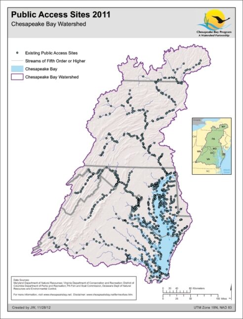
Protected Lands 2011
Date created: November 15, 2012This map represents a complete, aggregated layer of protected lands in the Chesapeake Bay Watershed and intersecting Counties as of 2011. It is a combination of multiple State, Federal and Non-Governmental Organization sources. Overlapping and duplicate areas have be deleted to address double counting.
View map
Chesapeake Bay Counties
Date created: July 22, 2008A map showing the counties (and sometimes municipalities) that are entirely or partially within the Chesapeake Bay basin.
View map
Protected Lands 2006
Date created: February 28, 2008This map shows Protected Lands in the Chesapeake Bay watershed as defined by the Chesapeake Bay Program. The data was acquired from various State Agencies and Non-Profit Conservation Organizations. The terms used to differentiate levels of protection are Public, Private, Agricultural Easement and Military. Public Lands: Includes lands identified as Local, State or Federally owned and managed. (e.g. - County Parks, State Forests, National Parks/Forests, Wildlife Refuge, etc.) Private Lands: Properties owned by private conservation groups or private lands encumbered with a conservation easement. Agricultural Easement: Properties protected under a State or local agricultural easement program. Military Lands: Lands owned and managed by different branches of the U.S. Military.
View map
Projected Population (2030)
Date created: February 13, 2008Population projections were produced by the Population Division of the U.S. Census Bureau. The projections were produced for the years 2001 to 2030, based on Census 2000 results, and the general assumption that recent state-specific trends in fertility, mortality, domestic migration, and international migration will continue.
View map
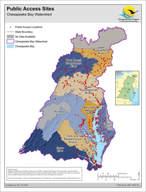
Public Access Sites
Date created: February 12, 2008Major public access sites within the Chesapeake Bay Watershed. The map's purpose is to enable people to find locations offering opportunities for boating, fishing, swimming, walking or hiking, wildlife observation and beach use.
View map