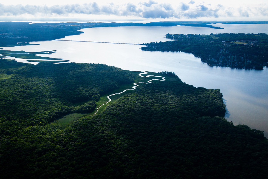
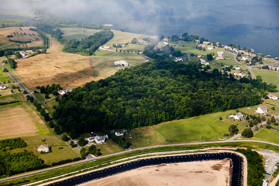
The Bird River flows into the Gunpowder River in Baltimore County, Maryland, on June 27, 2016. The 26-square-mile Bird River watershed is about one-third forested land and one-fifth agricultural land. It received Baltimore County's first comprehensive watershed plan in 1995 to address water quality issues caused by unstable stream channels, impervious surfaces, pollutants, mining, agriculture and other threats. Today, completed stream restoration along the mainstem and tributaries of Bird River total five miles. (Images by Will Parson)
Flying low over the Chesapeake Bay, it’s not actually the water that draws your attention—except for the sporadic glint of sunlight reflected off of its calm surface. Instead, it’s the patchwork landscape and the rate at which a quiet farm field gives way to grids of streets or wriggling stretches of wetlands.
And there’s another reason to pay attention to all that land: because the Chesapeake Bay is so shallow—its average depth is just 21 feet—and because so much land area feeds into it, the health of the Bay depends greatly on how the land is treated.
With the support of a volunteer pilot from the nonprofit organization LightHawk, we took a look around the northern edges of the Chesapeake Bay to see some of the ways the land has been shaped by the people living there.
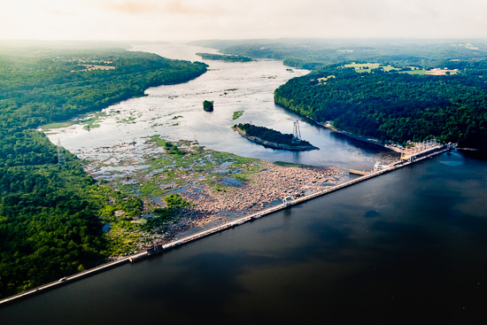
The Susquehanna River flows south past Conowingo Dam, toward Havre de Grace, Maryland. Conowingo Dam has long trapped sediment runoff originating from farms and other sources upstream. But as the dam nears 100 years of age, its capacity for trapping sediment is now at equilibrium, meaning it can only trap sediment in the short-term, after heavy storms scour away some of the buildup behind the dam.
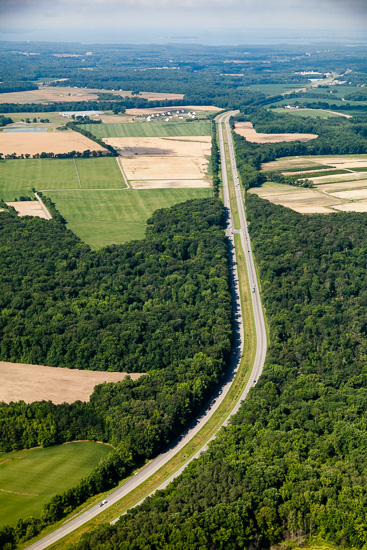
Maryland Route 301, known as Blue Star Memorial Highway, runs toward Queenstown, Maryland. An effort by the Eastern Shoreway Alliance (ESA) to get the stretch of highway designated a scenic byway stalled ten years ago. In the group's proposal, quoted in the Chestertown Spy news website, the ESA describes the area surrounding 301 as a "slowly woven tapestry of exceptionally rich farm fields and pastures, natural woodlands and meadows, tidal estuaries and marshes.”
Skipton Creek flows west into the Wye River in Talbot County, Maryland. The Wye River received a "C" grade overall in the Midshore Riverkeeper Conservancy's 2015 report card—the same grade as in 2014—with phosphorus pollution in the "D" to "D-" range.
A patch of forest is shaped by the manicured fields surrounding it near the Elk River in Cecil County, Maryland. As trees have been replaced with roads, buildings, farms and houses, 60 percent of the Chesapeake Bay watershed’s forests have been divided into disconnected fragments. This increases the amount of sun-exposed forest "edge"—where fields and forest meet—that favors invasive species and large populations of deer.
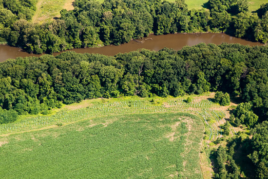
A recently planted riparian forest buffer borders an agricultural field along Emory Creek, which flows into the Corsica River in Queen Anne's County, Maryland. A lack of buffers is a major challenge for the restoration of the Corsica, according to the river's Watershed Restoration Action Strategy (WRAS) completed in 2004.
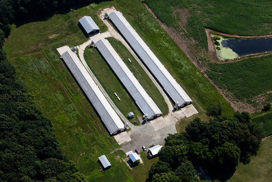
Chicken barns rise from a farm in Queen Anne's County, Maryland. Manure accounts for 19 percent of the nitrogen and 26 percent of the phosphorus entering the Chesapeake Bay, according to a 2010 report by the U.S. Environmental Protection Agency.
Poultry, corn, and soybeans are the dominant agriculture on the Eastern Shore currently, but industries have gone through boom-bust cycles on the Delmarva Peninsula since the early 1600s. Retirees, commuters and tourists have increased their footprint since travel became easier with opening of the Chesapeake Bay Bridge in 1952.
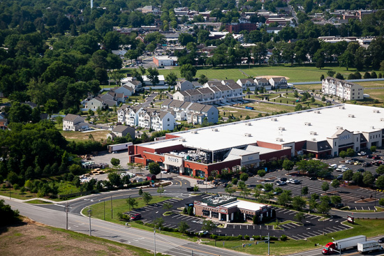
Box stores and townhouses spread through a suburban area of Easton, Maryland. The opening of the Chesapeake Bay Bridge in 1952 made travel to the Eastern Shore more convenient, literally paving the way for rapid population growth in the 1990s and early 2000s. The town of Easton grew by over one third between 1990 and 2003.
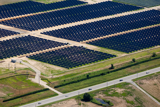
The 13.6-megawatt Wye Mills solar project features over 40,000 solar panels on 97 acres in Queen Anne's County, Maryland. The project, to be online in 2016, is set to deliver energy to Johns Hopkins University, which chose the remote site because of a lack of space near its campus in Baltimore.
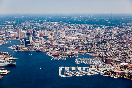
Baltimore's Inner Harbor is seen at the far left at the end of the northwest branch of the Patapsco River, which receives water from the mouth of Jones Falls. The Inner Harbor and tidal Patapsco River have received failing water quality grades for years, according to a report card published by the Healthy Harbor Initiative for the Waterfront Partnership of Baltimore.
Riprap and bulkheads harden a shoreline along Edgemere, Maryland, near North Point State Park in Baltimore County. Hardened shorelines eliminate the shallow habitat required by many of the small fish and invertebrates that trophy fish like striped bass eat, and can also make it hard for underwater grasses to take root in the turbulent waves reflected off the hard surface.
Patterson Park offers the only green space to much of the surrounding neighborhoods in Baltimore.
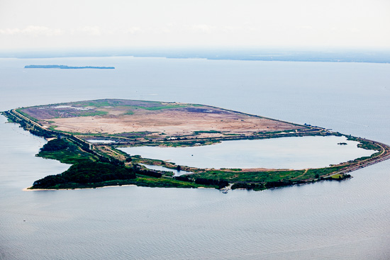
Hart-Miller Island State Park lies east of Baltimore in the Chesapeake Bay. The 1,100-acre island began as two distinct islands joined by dredged material in a restoration project overseen by Maryland Environmental Service. In 2016, the 300-acre south cell of the island opened to the public for the first time since the U.S. Army Corps of Engineers began dredging in 1981.
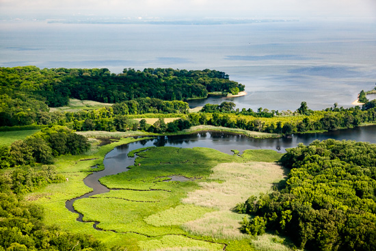
Wetlands flow into the Chesapeake Bay near the mouth of the Elk River in Cecil County, Maryland. Aberdeen Proving Ground, northeast of Baltimore, is visible in the distance. Shoreline development poses a major threat to wetland, but protected areas like Elk Neck State Park help protect portions of these habitats from destruction.
To view more photos, visit the Chesapeake Bay Program's Flickr page
Your comment has been received. Before it can be published, the comment will be reviewed by our team to ensure it adheres with our rules of engagement.

Comments
Thank you for a very nice article.
Thank you!
Your comment has been received. Before it can be published, the comment will be reviewed by our team to ensure it adheres with our rules of engagement.
Back to recent stories