Artificial reefs slow erosion, build habitat on Chester River
Scientists explain shoreline protection at the Eastern Neck National Wildlife Refuge.
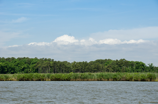
Across the Chesapeake Bay, strong waves crash into shorelines, pulling sand into the water and causing beaches to disappear. In recent decades, scientists have turned to living shorelines and stone reefs to slow this process—known as erosion—and create critical habitat for wildlife. On the Eastern Neck National Wildlife Refuge, one such project has proven successful on both counts.
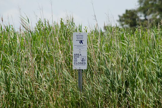
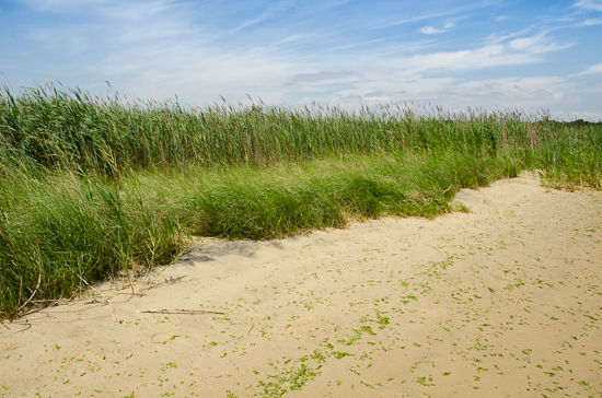
The 2,285-acre island refuge in Rock Hall, Maryland, is part of the Chesapeake Marshlands National Wildlife Refuge Complex and has long offered feeding and resting grounds to songbirds, shorebirds and waterfowl. When a narrow piece of land at its southern point—the highest priority habitat at the refuge—proved in danger of washing away, the U.S. Fish and Wildlife Service (USFWS), the Maryland Department of Natural Resources (DNR) and several other partners came together to slow the disappearance of the shoreline.
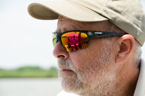
In June, USFWS Biologist Dave Sutherland—along with staff from the Maryland Artificial Reef Initiative (MARI) and Coastal Conservation Association Maryland, both of which are partners in this effort— took our team to the refuge to see the living shoreline and underwater reefs that made it a model of climate resiliency. Five years after construction on these projects began, pieces of land do still break off of the island’s long peninsula that separates Hail Cove, Hail Creek and the Chester River. But the goal was never to stop erosion: it was to slow it down without using the manmade structures that block critters from reaching the beach.
While shoreline erosion is a natural process, sea-level rise has amplified the impacts of wind and wave energy across the watershed. “I look at sea-level rise as a human-induced issue that’s exacerbating what used to be a slower, natural process,” said USFWS Fisheries Biologist John Gill. “Not to say it wasn’t happening before. Just that its rate has increased. And it’s tougher for marshes to keep up.”
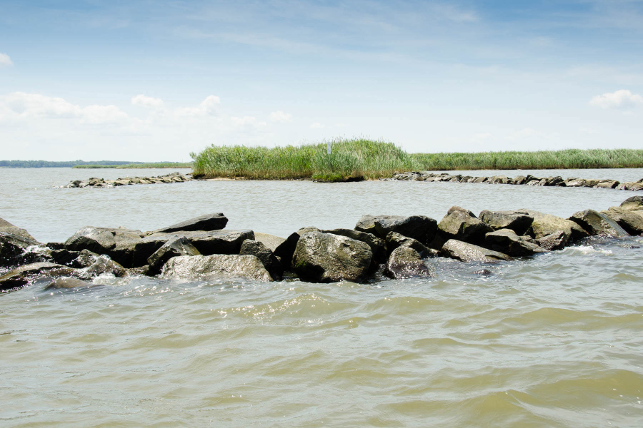
For Gill, the Hail Cove restoration project achieves “a nice balancing act” in its use of manmade infrastructure and the natural environment. The essential elements? Headland breakwaters, underwater reefs and a living shoreline. “You’re working with Mother Nature, but still providing erosion control,” Gill said.
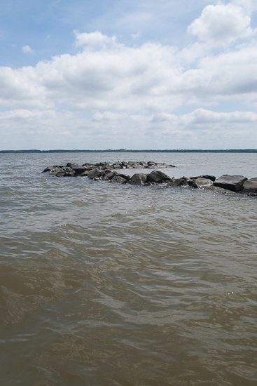
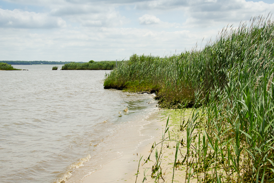
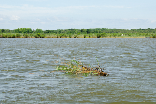
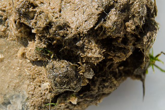
Low headland breakwaters placed at each end of Hail Cove maintain the pocket beach, blocking wave energy that might otherwise destroy the shore. A long ribbon reef deemed the “arc of stone” stretches across the cove, offering further protection for the beach and vital habitat for fish, shellfish and invertebrates.
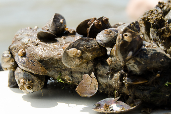
Hooked mussels colonized the ribbon reef soon after it was built, and eastern oysters that were planted there with volunteer help continue to thrive. Algae grow on the granite rocks, small fish live in the reef’s tiny crevices and waterfowl find a source of food on their migrations over the Bay. “A lot of species are habitat-starved, and this [arc of stone] provided a lot of what they need,” Sutherland said. “It’s well-populated with cobies and blennies and worms and macroalgae. It’s really a fantastic habitat.”
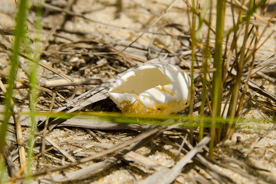
Sutherland and his team soon recognized the benefits of installing infrastructure that allowed access to the beach: three weeks after sand was put down, engineers discovered nine diamondback terrapin nests on the shore, proving just how “habitat-starved” these native turtles were.
The Hail Cove project was completed this spring when 11 patch reefs—using one acre of material in all—were laid down over the two and a half-acre cove. The reefs will expand the underwater habitat that is so important to so many critters but has been lost with the decline of the Bay’s native oyster. For Sutherland, these reefs were “the icing on the cake. If the arc of stone is good, the patch reefs are going to be even better,” he said.
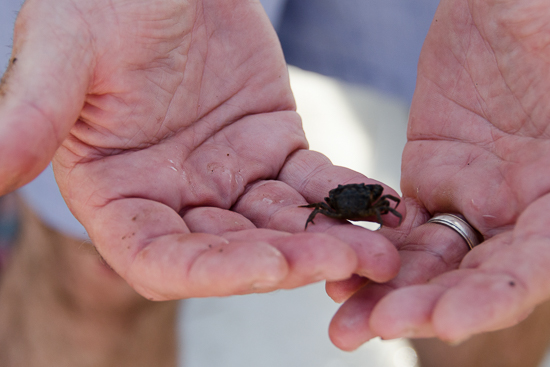
DNR Fisheries Biologist and MARI Coordinator Erik Zlokovitz echoed Sutherland’s satisfaction with the project. “This is a multipurpose shallow-water reef system. It’s not just an oyster reef or a fish reef. It’s a multipurpose reef for mussels, oysters and other invertebrates, which provide forage for fish and waterfowl,” he said.
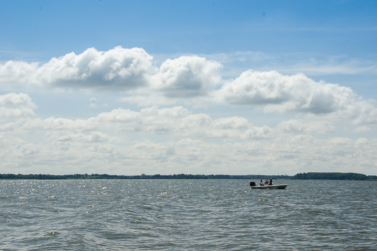
The reef has also attracted recreational anglers to the area, who fish from kayaks and small boats for white perch and striped bass. Coastal Conservation Association Maryland, whose members are recreational fishermen, was a strong supporter of the Hail Cove project. For Sutherland, the cove’s restoration wouldn’t have been a success without the “great partners” that made it possible.
“Living shoreline science is really in its infancy, and every project is an experiment,” Sutherland said. But bringing partners together to strike a balance between manmade infrastructure and natural processes allowed this project to work, and Hail Cove now serves as “a starting point for reef construction in the Chester River,” said Sutherland. Indeed, relief funds for Hurricane Sandy recovery will soon finance further shoreline protection in the same area of the refuge.
“This project is a testament, to a certain extent, that if you build it, they will come,” Sutherland said. “We got to Hail Cove in the nick of time.”
To view more photos, visit the Chesapeake Bay Program Flickr page.
Images by Alexander Jonesi and Jenna Valente. Captions by Catherine Krikstan.
Comments
There are no comments.
Thank you!
Your comment has been received. Before it can be published, the comment will be reviewed by our team to ensure it adheres with our rules of engagement.
Back to recent stories