Military installations on the front lines of coastal protection
Air Force, Navy show that shoreline restoration benefits more than wildlife
Back River empties near the mouth of the Chesapeake Bay in Hampton, Virginia. It’s not long—only about two miles—but it splits into a north and south branch, both of which wrap around much of the Air Force’s Joint Base Langley-Eustis.
With so much coastline, Langley is particularly vulnerable to the effects of climate change, including sea level rise and stronger storms. And while the seas are rising, the land on which Langley sits is also sinking, or subsiding.
“If you think of the Hampton Roads area or here on Langley,” says Alicia Garcia, the base’s natural resource program manager, “you can think of it as a milkshake with whipped cream on top. If you drink down the milkshake, the whipped cream is going to sink down, in much the same way the land in this area is going down in elevation.”
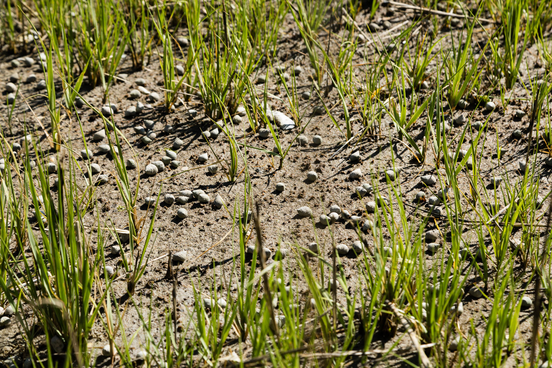
Sinking land and rising seas make Langley much more vulnerable to flooding, so the Air Force is trying to protect its base by investing in its shorelines. So far, they have completed over 3,000 feet of shoreline restoration. Not only will the restored shorelines increase the installation’s resilience to major storm events, they will also provide habitat for animals. Garcia points to areas of restored shoreline she describes as ideal for diamondback terrapins, and she identifies other species of plants and snails that signal a successful restoration effort.
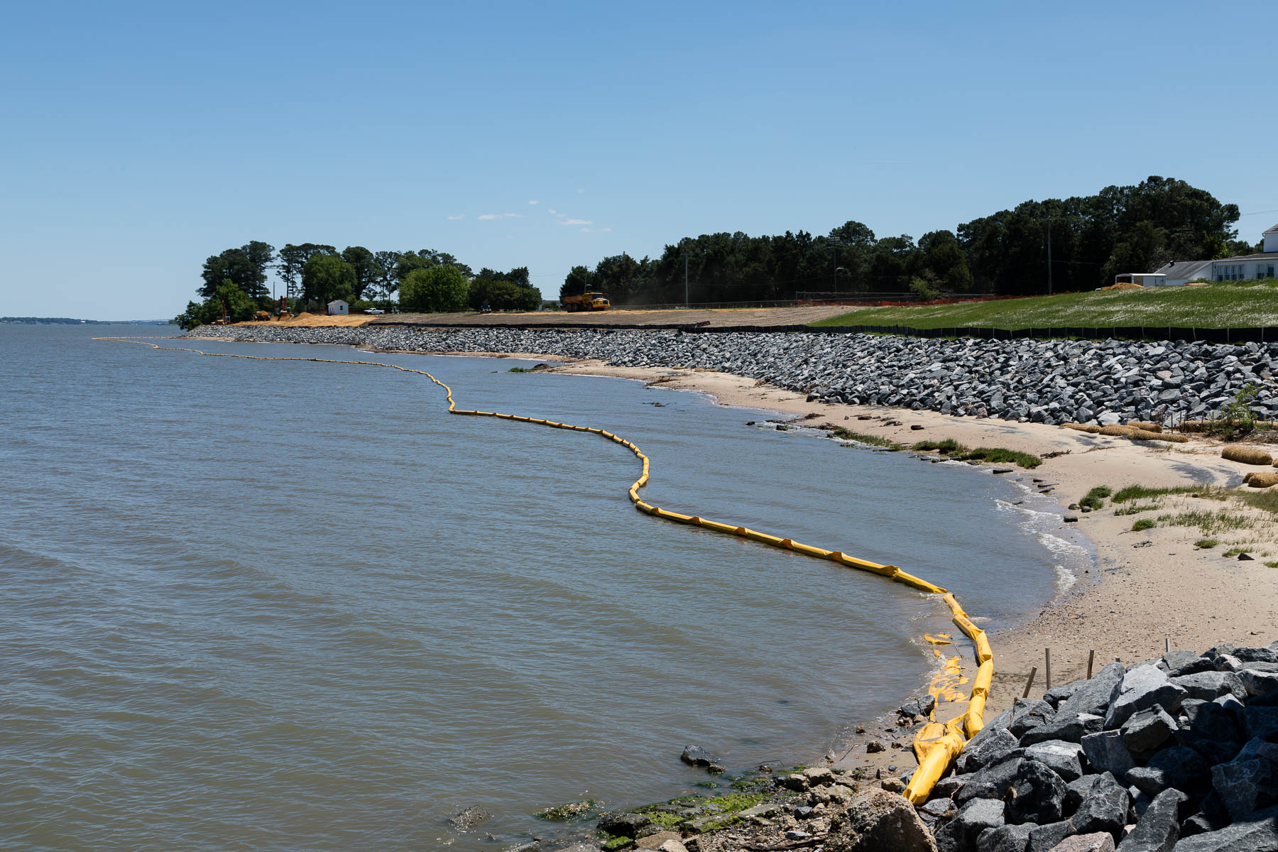
The project isn’t over yet. Another 1,150 feet of shoreline are planned to be restored outside of the oldest building on the base, which has suffered damage due in part from flooding. Right now, the shoreline outside the building is a mixture of invasive species and large chunks of broken-up concrete that were strewn across the shoreline decades ago. “It’s basically construction debris,” says Garcia as she points to the concrete. “It doesn’t lend itself to actually stopping erosion.”
The size of soil particles that a wave can carry is related to the amount of energy in the wave, Garcia explains. If a wave with a lot of energy were to come and hit against the large concrete chunks, it will rush through the large gaps and take out much of the sand and sediment that was there. “Look under here,” Garcia says as she squats down to look through the chunks of concrete. “You can see daylight.”
The plan is to put in a sill that has a more natural slope, which will diffuse wind and water energy before it hits the bank while also allowing native plants to establish themselves. “When we increase access to the shoreline for native species you get an increase in biodiversity as well as flood insurance,” Garcia explains. “We get protection from energy inputs of wind and water when you have major storm events.”
Nearby, the Navy is also working on shoreline restoration. Just up the highway is the Cheatham Annex section of Naval Weapons Station Yorktown. This facility also shares quite a bit of its boundary with a waterway, the York River.
Cheatham Annex plays an important role for the Navy in terms of cargo handling and logistical support, and its pier that stretches into the York is key to fulfilling that mission. However, eroding shorelines along either side of the pier posed a threat to the installation’s main supply hub, according to Thomas Olexa, the installation’s natural resources manager. On top of that, concerns about potential contamination from netting that had been repurposed as shoreline stabilization caused the Navy to take action.
Now, they’re working to stabilize and restore that shoreline. The netting was removed and the shorelines regraded to create a gentler slope. They installed riprap—a layer of rock to help stabilize the shore—and will be planting wetland plugs in front of it to help absorb incoming wave and wind energy. They’ve also added a pollinator meadow on the land uphill from the shoreline.
The work they’re doing around the pier is similar to work already completed further north in Cheatham Annex. A road running along the shore was badly compromised due to the deteriorated riverbank. Much of the bank was washed out during Hurricane Isabel in 2003, turning the coast into “basically a cliff face,” says Olexa. Completed in 2014, the shoreline restoration project stabilized the riverbank, and new wetland vegetation helps absorb wind and wave energy.
Restoration work is not antithetical to military operations, say Garcia and Olexa. The Air Force wants to prevent flooding of its buildings and runways, and the Navy wants to protect what they call key assets to supporting their mission. But projects that support the military can also support wildlife habitat and water quality.
“While the intention was to prevent flooding on [Langley] and to make the base more resilient to these major storm events that we have,” says Garcia, “the secondary benefit is that we get some habitat for animals like turtles that don’t impact our mission, so it’s a win-win.”
Comments
There are no comments.
Thank you!
Your comment has been received. Before it can be published, the comment will be reviewed by our team to ensure it adheres with our rules of engagement.
Back to recent stories