Satellites, solar-powered buoys and volunteers like you help monitor the Bay
To restore the Chesapeake Bay watershed, our partners carry out a myriad of projects across the region, from installing oyster reefs to planting trees to upgrading lagging infrastructure. The success of these initiatives hinges on consistent and high-quality monitoring that tells us where to focus our efforts and to what extent our work is improving conditions. Whether it’s from space, the surface of the Bay or a backyard stream, we are constantly keeping tabs on the estuary in state-of-the-art and innovative ways.
Monitoring tours
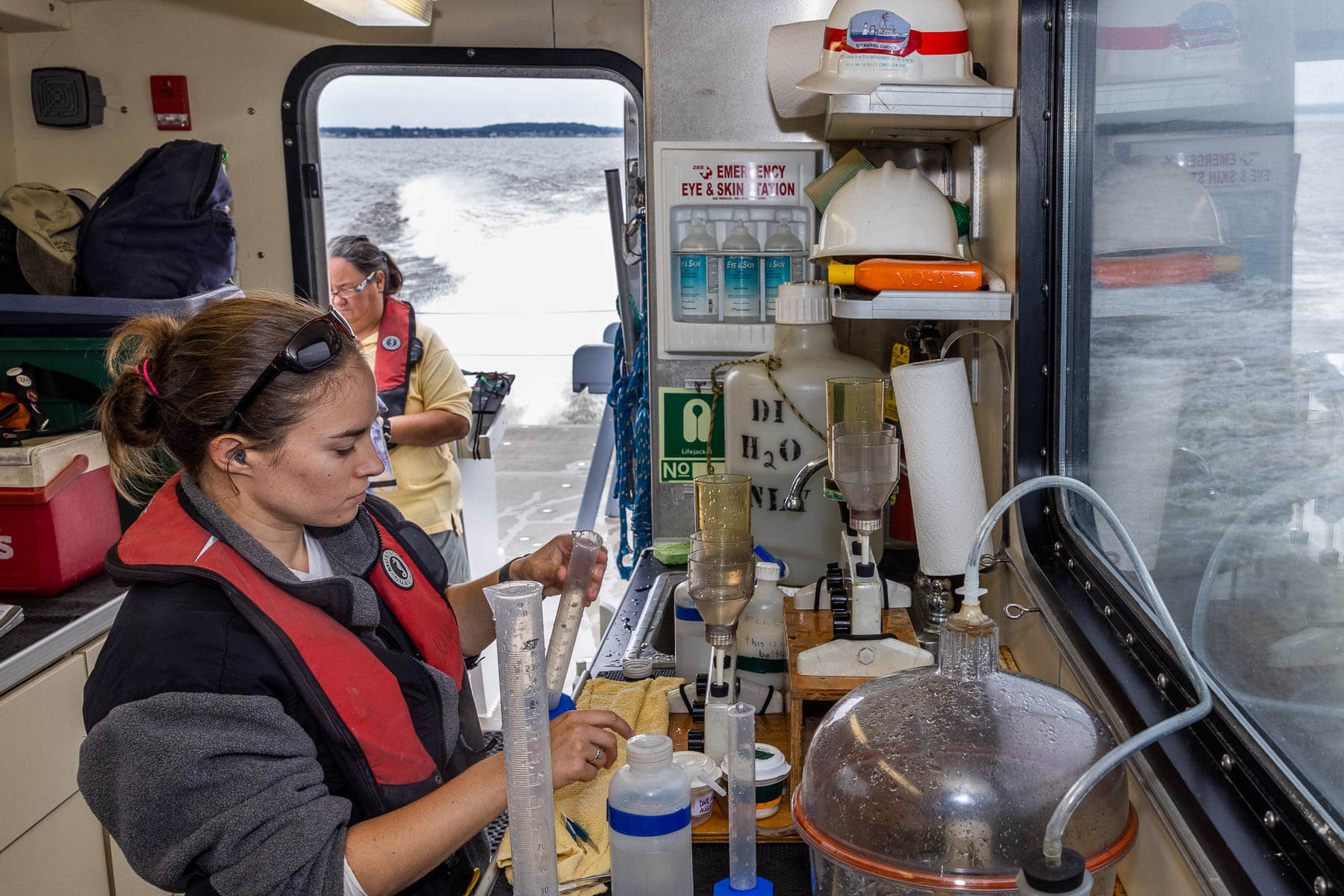
The bulk of our water quality data comes from two sources: the tidal monitoring program and watershed monitoring network. Through the tidal monitoring program, the Maryland Department of Natural Resources and Virginia Department of Environmental Quality work together to sample at 154 sites within the main stem and tidal waters of the Bay at least once a month. At each station, assessments are made by measuring temperature, salinity and dissolved oxygen at different depths through the water column. Throughout the entire watershed, the watershed monitoring network collects samples to measure nutrients and sediment in rivers and streams at 125 sites once a month and during storms. The trends provided by this data are updated by the U.S Geological Survey (USGS) every two years.
Satellite imagery
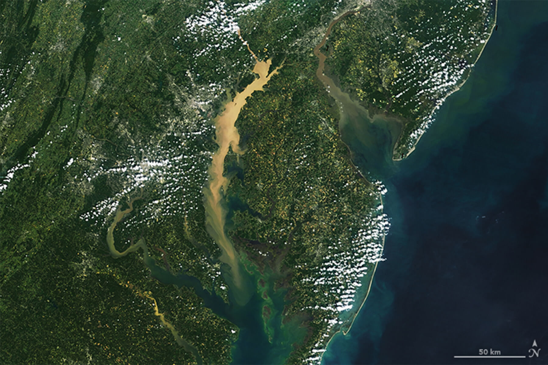
While ships are out in the water collecting samples, satellites are up in space documenting changes. At the Chesapeake Bay Program, we utilize data from NASA Landsat Imagery, a satellite developed, launched and operated by the National Air and Space Administration (NASA) and USGS. Thanks to these sky-high images we can detect changes such as increased sediment or algae in a river or part of the Bay, which helps us understand where harmful dead zones may occur. The Virginia Marine Institute, who contributes to our measurement of submerged aquatic vegetation, uses satellite imagery for their aerial surveys.
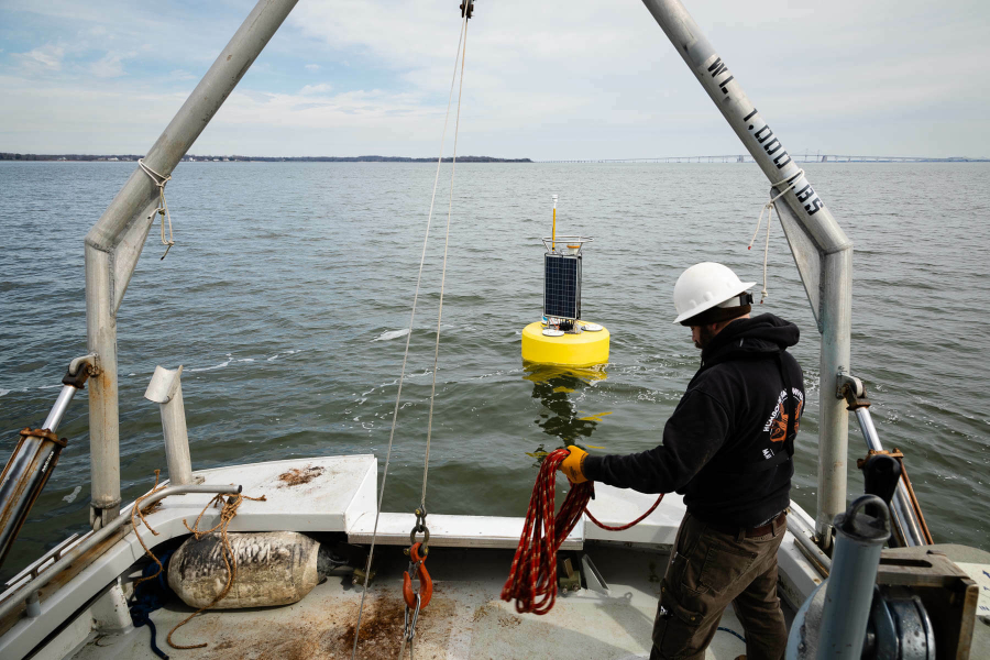
High-tech buoys
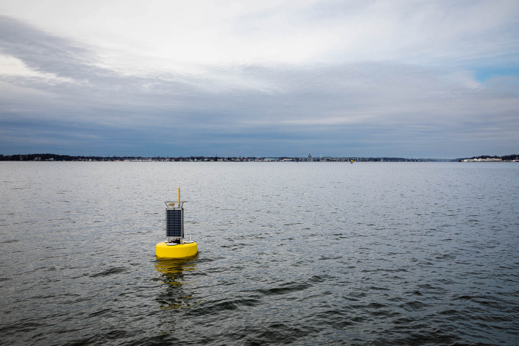
If you’re out on a paddle and come across a particularly sophisticated-looking buoy decked out in solar panels, sensors and antenna, you might have found a feature of the Chesapeake Bay Interpretive Buoy System (CBIBS). Unlike our monitoring cruises, which visit sites weekly or monthly, these buoys send real-time data 24/7. CBIBS currently includes six buoys, located in Annapolis, Gooses Reef, Potomac River, York Spit, Stingray Point and Jamestown. They track meteorological conditions like air temperature, wind speed and direction, barometric pressure, as well as water quality near the surface of the water. The National Oceanic and Atmospheric Administration (NOAA) also has observation platforms in the water that track dissolved oxygen, temperature and salinity at several points between the surface of the water and the bottom of the Bay.
Community scientists
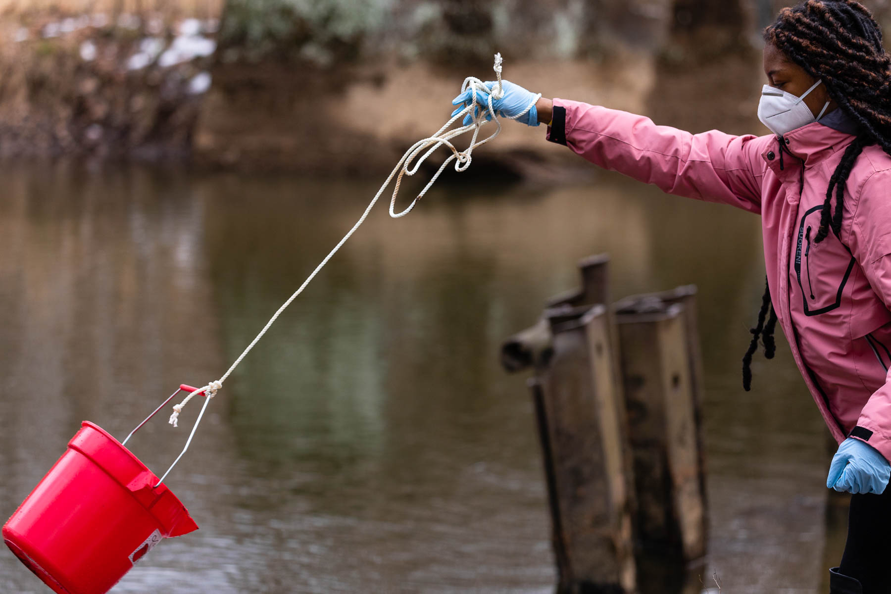
For the thousands of Chesapeake Bay tributaries that our researchers can’t get to, we rely on an amazing group of volunteers from the Chesapeake Monitoring Cooperative (CMC). Established in 2015, the CMC works with water quality monitoring groups from across the watershed to recruit and train volunteers, ensure unified sampling methods and feed data into a Bay Program tool called the Chesapeake Data Explorer. If interested in volunteering, you can use the Chesapeake Data Explorer to find monitoring groups in your area. And if you need help connecting with a local monitoring group, fill out the CMC Application for Assistance form.
Want to learn more about how the data we collect informs restoration efforts? Check out our Bay 101 video, Monitoring and Modeling the Chesapeake Bay.
Comments
That is a very powerful image of silting in the watershed. May I see one for the South, West, and Rhode Rivers area on the Western Shore?
Thank you!
Your comment has been received. Before it can be published, the comment will be reviewed by our team to ensure it adheres with our rules of engagement.
Back to recent stories