The picturesque Manokin River hosts an oyster reef sanctuary
With preserved natural areas, historic buildings and fishing communities, the Manokin is like a river out of the past.
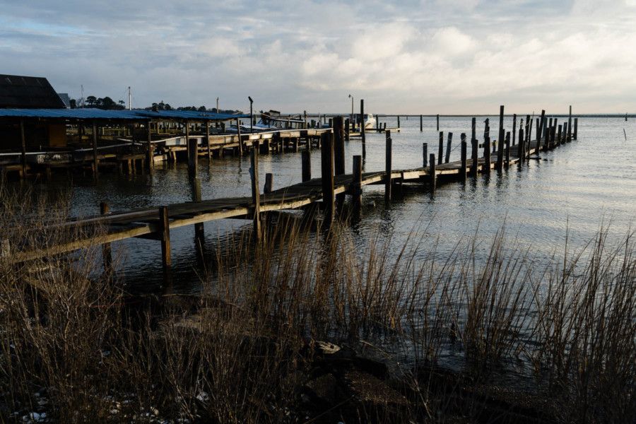
The Manokin River in Somerset County, Maryland, is one of the Bay’s most iconic and picturesque tributaries. This 17-mile long river is engulfed in farmland and small towns where many residents make a living harvesting and selling fish and shellfish. A slew of historic buildings stretch from Princess Anne County to Somerset County, marking the history of early European settlers.
The river’s headwaters start in Princess Anne and flow into the Chesapeake Bay, merging into the Tangier Sound. A large portion of the land surrounding the river is designated as habitat for migratory birds and other wildlife: on the north side of the Manokin, Deal Island Wildlife Management Area’s 9 miles of trails and scenic roads offer views of great egrets and colorful summer sunsets, and to the south, Fairmont Wildlife Management Area is home to waterfowl in the winter and migratory shorebirds in spring and autumn. These natural lands help ensure that much of the river remains protected.
At the river’s mouth, historic buildings dating from the early 18th to the mid 20th centuries paint a picture of the Manokin’s past inhabitants. The buildings are located on a property known as the “Manokin Settlement,” and are united by a web of family connections. Added to the National Register of Historic Places in 1976, the Manokin Historic District offers a vista downriver to Tangier Sound and upriver to Princess Anne that’s believed to remain unchanged from the 17th century.
In 2019, the Chesapeake Bay Program selected the Manokin River as the tenth Chesapeake Bay tributary for large-scale oyster reef restoration. The Chesapeake Bay Watershed Agreement calls for the restoration of the native oyster population in 10 tributaries by 2025—and the Manokin River was the final tributary to be selected for this partnership effort.
As of now, 96 acres of oyster reef have been completed and partners expect the final 345 acres to be completed in early fall, 2025. Harvesting is not allowed over this oyster reef sanctuary, though the habitat created is a boon to local oyster and fish populations, benefiting the health of the river.
Comments
Manokin River and surrounding communities are a treasure worth preserving and cherishing in every way. We also need to appreciate and support those who are part of this effort. It is time to turn a new page in history in which humans and nature could coexist and support and enhance each other. It can be done.
Be sure to visit MD DNR's Eyes on the Bay website. We have a continuous water quality monitor in the Manokin, as well as monthly surface water quality mapping.
http://www.eyesonthebay.net
Thank you!
Your comment has been received. Before it can be published, the comment will be reviewed by our team to ensure it adheres with our rules of engagement.
Back to recent stories