The Pocomoke River adds a bit of bayou to the Chesapeake
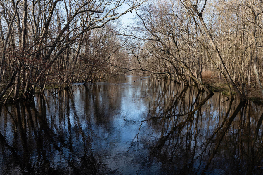
Bald cypress trees emerge from the water, their branches convoluted and their greenery draping, haunting and lush. The scene seems to belong in Louisiana, Mississippi or any other place you’d expect to find alligators, Cajun river monsters and Spanish moss.
But this is Delaware—Sussex County, home of the Great Cypress Swamp. This large wetland area is where the headwaters of the 73-mile-long Pocomoke River begin. With depths ranging from 7 to 45 feet and a width of less than 100 feet, the Pocomoke is rumored to be the deepest river for its width in the world.
The Great Cypress Swamp is the northernmost place that you will find bald cypresses in the United States. These iconic swamp giants live among high water levels, using knots (or “knees”) on their trunk near the water’s surface to take oxygen from the air and send it to their root system underwater, kind of like a snorkel!
Acid from the bald cypress roots contributes to the Pocomoke’s dark, amber color. This may be what gave the river its name; locals will tell you that Pocomoke means “black water.” However, some historians believe the name comes from an Algonquian term meaning, “pierced or broken ground.” We’re not sure who’s right or wrong, but the color of the water is unique and certainly adds to the mysteriousness of the tributary.
As the Pocomoke flows south into Maryland, it forms the boundary between Wicomico and Worcester counties. At Porter’s Crossing, the river begins to narrow as it flows southwest. It runs through Snow Hill and Pocomoke City before emptying into Pocomoke Sound and into the Chesapeake Bay.
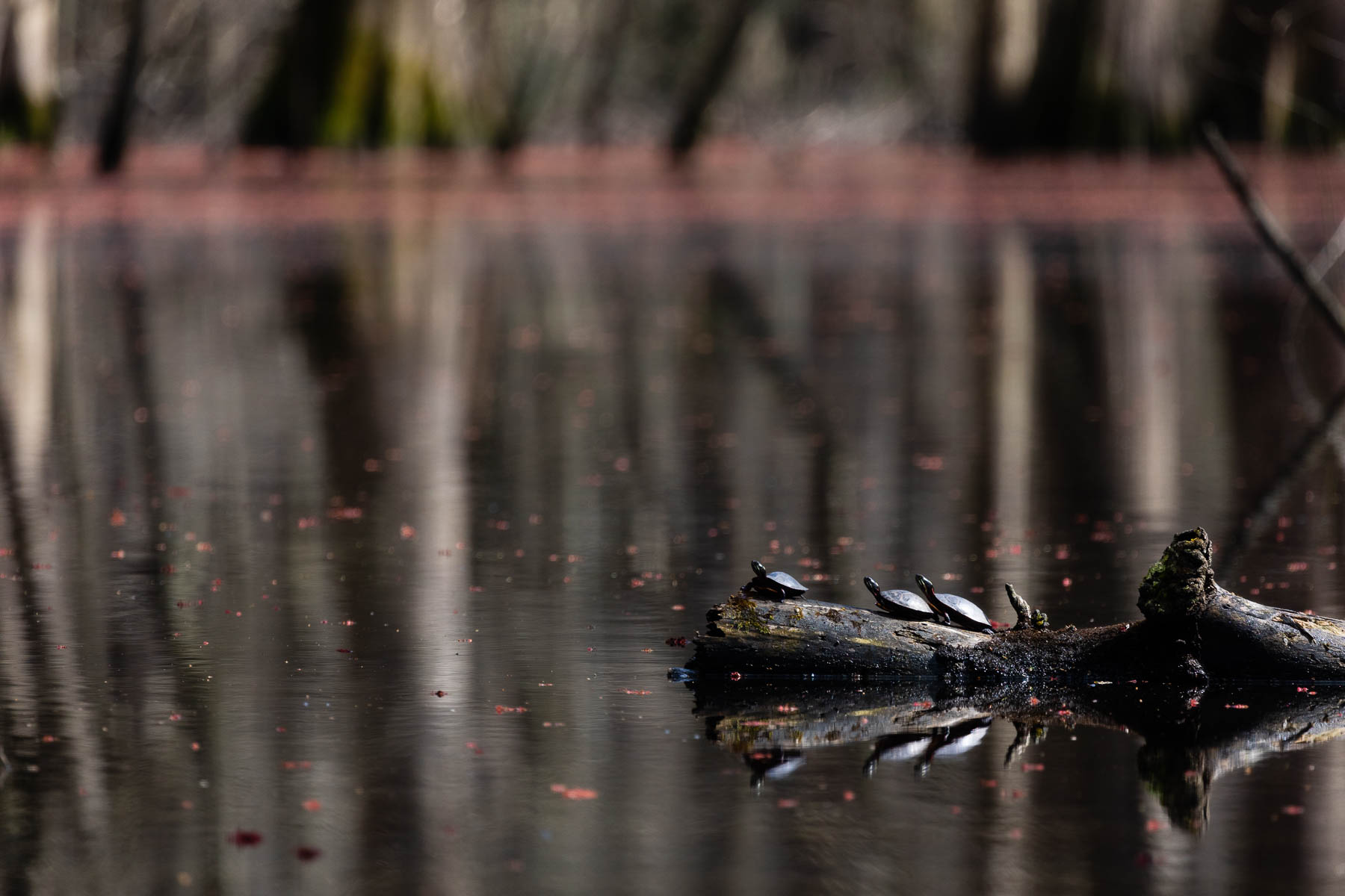
Along the way, you can find birds—and lots of them! One hundred seventy-two different species have been recorded in the area. The Pocomoke’s marshes are some of the best places in the Atlantic Flyway to observe both warblers and waterfowl.
If you’d like to take to the “black water” yourself, check out local canoe and kayak rental companies in Pocomoke City and Snow Hill. Hiking trails in Pocomoke River State Forest, Pocomoke River State Park and the Nassawango Preserve of The Nature Conservancy reveal views of the swamps surrounding the river. If you’re lucky, you can get up-close and personal with some of the river’s non-human residents!
For you history buffs, be sure to visit the Furnace Town Living History Museum, a nature and archeology site dedicated to preserving the history of the Nassawango Iron Furnace, started in 1829 near Snow Hill.
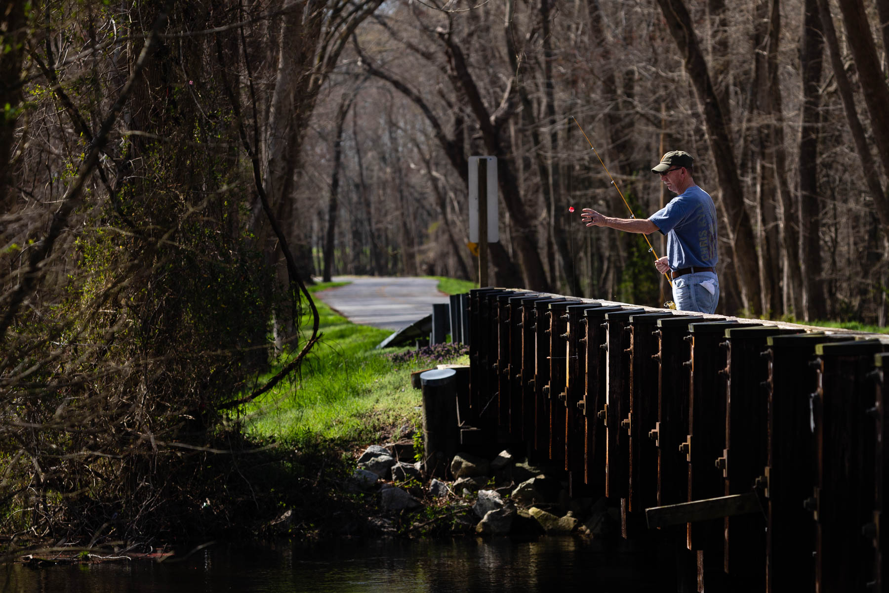
Fishing is also excellent in the Pocomoke. Expect to find largemouth bass and panfish, but keep a lookout for pickerel and longnose gar. Since the Pocomoke is a tidal tributary, you need to anticipate shifts in the tide so your boat doesn’t become stuck or washed out into the water. Figuring out the tides is key to having a good fishing experience!
Since the Pocomoke is a tributary of the Bay, it’s important to track the river's water quality. The Chesapeake Bay Program has been collecting data on Lower Eastern Shore tributaries since 1985 and recently published a summary looking at long-and-short-term pollution trends for the area. According to the study, the Eastern Shore tributaries including the Pocomoke River have high levels of phosphorous compared to other areas of the Bay. This is primarily due to the prevalence of farming in the region. Fertilizer applied to crops can end up in the soil and then streams. Sandy soils, such as those found on the Eastern Shore can become saturated by phosphorus quickly. Though many farmers in the region are utilizing best practices to reduce nutrient runoff, it can take a decade or more to reduce phosphorus concentrations.
Smart land management will help keep this magical destination healthy, and ensure it isn’t sending nutrient and sediment-heavy water into the Bay.
Have you been to the Pocomoke River? Tell us all about it in the comments!
Comments
The best way to see the Pocomoke is from a canoe or kayak. The Pocomoke River Canoe Company can rent boats, or portage private boats, to the northernmost navigable parts of this beautiful river. 410-632-3971 www.pocomokeriverpaddle.com Open throughout the fall.
My wife and I lived aboard our 40 ft. trawler for eleven years, cruising the ICW from Fla. to Del.. We spent nearly every summer on the Chesapeake Bay, with Cape Charles as our hub, and we never missed an opportunity to motor up the Pocomoke River. My wife and I don’t always agree on everything but we definitely agree on the Pocomoke being the most beautiful river in the world! The abundant wildlife and spectacular trees and vegetation are a sight to be seen!
I, like many other was raised around and by this river. Spent many days fishing, like at Porters Crossing and cycling to the river at different locations. As a child one does not appreciate what they are living around. Snow Hill and the Pocomoke was and is a gem for children and adults.
My family has lived in Pocomoke City for at least 4 generations. The river is very beautiful. When I first saw it as a child, I was awe struck because it looked so deep and mysterious. It is worth seeing.
Thank you!
Your comment has been received. Before it can be published, the comment will be reviewed by our team to ensure it adheres with our rules of engagement.
Back to recent stories