About a buoy
When you’re out on the Chesapeake, these bright yellow buoys are hard to miss. Laden with sensors and powered by solar panels, they form the Chesapeake Bay Interpretive Buoy System (CBIBS), a network operated by the National Oceanic and Atmospheric Administration (NOAA) that delivers real-time data on weather and water conditions. The information is available online for anyone to access via the CBIBS website and Smart Buoys app.
Of interest for boaters and paddlers, the buoys gather and transmit data on wind speed, temperature and wave height. Meteorologists use the buoy data to make weather forecasts. Teachers can use the data—including measures of water quality like temperature, salinity, dissolved oxygen, turbidity and concentrations of chlorophyll a (a measure of algae growth)—in classroom science investigations. The buoys also mark points on the Captain John Smith Chesapeake National Historic Trail.
Formerly employing up to ten buoys, CBIBS currently relies on seven buoys spanning Maryland and Virginia. A new buoy design is gradually replacing an older model used for the network. The new buoys are smaller, making it easier to replace sensors and re-deploy the buoys from the NOAA Chesapeake Bay Office’s research vessel.
Two buoys of the older model, which dates back to the start of CBIBS in 2007, still remain on the water in Virginia. But plans are in place to replace them this year, and with new buoys comes updated equipment.
“It’s impressive how much technology has evolved in just over a decade!” said Kim Couranz of NOAA.
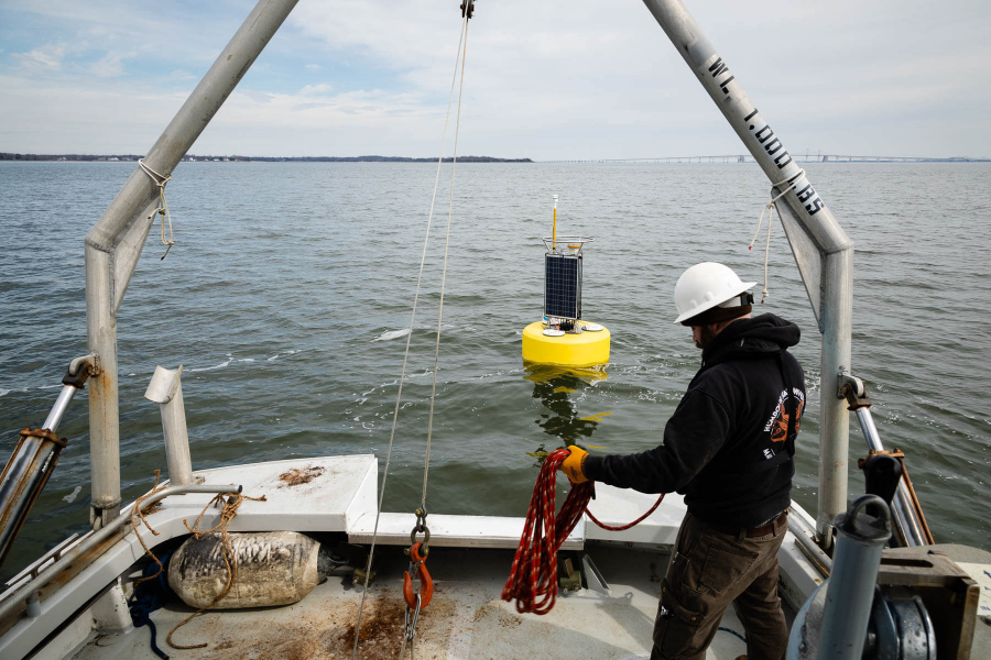
On a March morning, Couranz joined a team of buoy technicians and NOAA staff as they re-deployed a buoy in the Severn River near Annapolis, Maryland. Every winter, some of the northern-most buoys are temporarily removed to avoid damage from hard freezes. That included the Annapolis buoy, but because of the mild winter, it was back on the job a little earlier than expected.
Over about an hour, the team carefully positioned the buoy at the correct GPS coordinates, lowered it from cables into the water, and inserted sensors. After confirming the buoy was operational using a laptop on board, they were finished.
“It was tracking the data immediately,” Couranz said.
Hitting the water around lunchtime, the buoy was sending data online later that same afternoon.
Comments
There are no comments.
Thank you!
Your comment has been received. Before it can be published, the comment will be reviewed by our team to ensure it adheres with our rules of engagement.
Back to recent stories