Bohemia River and its ties to a famous Chesapeake Bay mapmaker
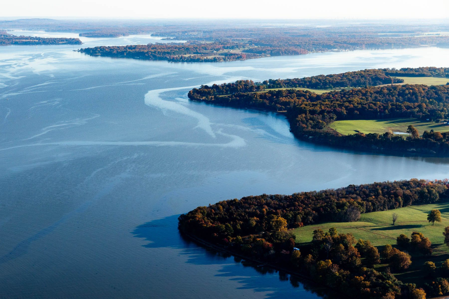
This Chesapeake Bay tributary starts in Delaware and flows to the upper Chesapeake Bay
The Chesapeake Bay was among the first regions on the continent inhabited by European explorers, making Maryland’s Eastern Shore a hub of activity as England, the Netherlands and Algonquin tribes jockeyed for control of the land.
In the 1650s, the Dutch colonists of New Netherland, which included New Amsterdam (New York), wanted to extend their rule into Maryland. They sent a man named Augustine Herman to Maryland’s colonial capital, St. Mary’s City, to present their case to Cecil Calvert, the Second Lord Baltimore, for Dutch ownership of contested lands on the western shore of Delaware Bay. Herman’s expedition left from New Castle, Delaware, and sailed down the modern day Bohemia River (known as the Oppoquermine River to Indigenous people), to the Elk River, and then into the Chesapeake Bay.
Although Herman and his team weren’t able to convince the Maryland governor to allow the Dutch to expand their borders, Herman was so impressed with the region’s beauty that he decided to settle there himself. After striking a deal with Calvert and the Council of Maryland, Herman received several thousand acres in northeast Maryland, between the Elk River and the Bohemia River. Since Herman was a native of Prague, which was then in Bohemia, he named his new home “Bohemia Manor,” inspiring the river’s new name.
As part of the deal, Herman agreed to create a map of Virginia and Maryland’s coastal waters, which included the Chesapeake Bay and its tidal rivers. The map took Herman ten years to finish and was the most accurate map of the Bay to date. Then, as now, Maryland and Virginia relied heavily on the estuary for transporting and trading goods.
Through his explorations, Herman observed that the Chesapeake Bay and the Delaware River were separated by only a thin strip of land. He predicted the concept of the Chesapeake and Delaware Canal, constructed nearly 150 years later, which connects the two bodies of water. In 1661, he wrote, “the Mingaskil and aforesaid Bohemia River run there within a league [3 miles] from each other from where we shall in time have communication with each other by water."
The Chesapeake and Delaware Canal is still in use today, carrying about 40% of the ship traffic headed to the port of Baltimore. The Bohemia River is no longer a critical maritime route, but is home to recreational boaters heading in and out of the Chesapeake Bay. The 460-acre Bohemia River State Park is a great place to hike, hunt, fish and access the water. And Herman’s Bohemia Manor is now a farm, winery and resort.
According to Native Land Digital, tribes that are indigenous to the Bohemia River include the Susquehannock, Lanepehoking, Piscataway, and Tockwogh.
To get involved in the protection of the Bohemia River, reach out to Friends of the Bohemia.
Comments
Since we moved to the Eastern Shore 6 years ago it appears that the number of cargo ships has decreased. Anyone know why?
Thank you!
Your comment has been received. Before it can be published, the comment will be reviewed by our team to ensure it adheres with our rules of engagement.
Back to recent stories