Chesapeake Steward Map
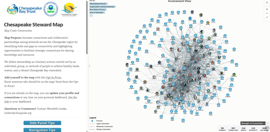
In ProgressThe goal of the Chesapeake Steward Map is to increase connections and collaborative partnerships among stewards across the Chesapeake region. The map helps identify hubs and gaps in connectivity and highlights opportunities to facilitate strategic connections for sharing knowledge and resources.
Description
Map Purpose: Increase connections and collaborative partnerships among stewards across the Chesapeake region by identifying hubs and gaps in connectivity and highlighting opportunities to facilitate strategic connections for sharing knowledge and resources.
Join and explore the map!
Any individual who identifies as a steward of the lands, waters, wildlife, fisheries, or communities of the Chesapeake Bay watershed is welcome to add themselves to the map and use the tool. We define stewardship broadly as voluntary actions carried out by an individual, group, or network of people to achieve healthy lands, waters, and a vibrant Chesapeake Bay watershed.
Explore the map without a profile with the Chesapeake Steward Map Exploration Link.
Add yourself to the map with this Opt-In Form.
If you are already on the map, you can update your profile and connections at any time on your personal dashboard. Get your personal dashboard link via email.
- Map Tip: We recommend favoriting your personal dashboard for easy access.
Questions or Comments?
- Contact Meredith Lemke, lemkem@chesapeake.org, Staffer - Chesapeake Bay Program
- Review the answers to Frequently Asked Questions
- Read the Chesapeake Steward Map User Guide