Final Chesapeake Bay interpretive buoy back on the water for spring
NOAA interpretive buoy system offers data on water and weather conditions

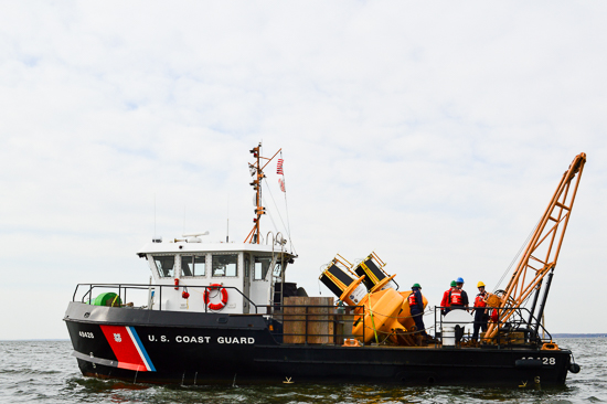
The official start of spring may have already passed, but one of the unofficial signs of the season arrived when the National Oceanic and Atmospheric Administration (NOAA) redeployed its final Chesapeake Bay Interpretive Buoy System (CBIBS) buoy today. All ten buoys—located along the Captain John Smith Chesapeake National Historic Trail—are now collecting and transmitting real-time data about conditions in the Chesapeake Bay.
CBIBS buoys offer valuable information to sailors, kayakers and others looking for information on wind speed, currents, wave heights and local conditions before heading out on the water. In addition to water and weather conditions, the buoy data provides a snapshot into what is happening in and around the Bay, including information on water temperature, salinity and dissolved oxygen.
To learn more about the buoys and the technicians that support them, watch our From the Field video:
All of the data collected by the CBIBS buoys is free to the public and can be accessed online, by phone at (877) 286-9229 and via a mobile app.
Comments
There are no comments.
Thank you!
Your comment has been received. Before it can be published, the comment will be reviewed by our team to ensure it adheres with our rules of engagement.
Back to recent stories