Population Growth
Population growth and development across the Chesapeake Bay region threaten forests, farms and other valuable landscapes, and create more pathways for pollutants to enter our air and water.
With its strong economy, diverse communities and rich natural and historic resources, it’s no wonder that more than 18 and a half million people call the Chesapeake Bay watershed home. But as more people move into the region, more land is cleared for the development of roads, homes and businesses, often at the expense of forests, farms and other valuable landscapes.
How has the Chesapeake Bay region's population grown?
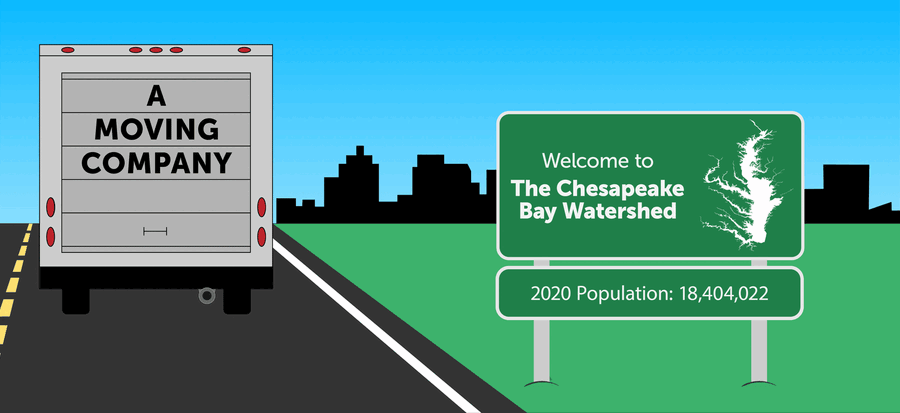
Since 1950, the human population in the Chesapeake Bay region has more than doubled. Between 1980 and 2024, this number rose roughly 49%, from 12.7 million people to 18.9 million people. While the rate of population growth is expected to slow in the coming years, the region's population is expected to surpass 20 million people by 2040.
Show image description
The animated infographic shows a moving van driving toward a rapidly developing city. Next to the road is a sign that reads, "Welcome to the Chesapeake Bay watershed." A smaller sign shows the region's population. The 2022 population is 18.6 million people. As the city expands, the region's projected population grows larger. In 2030, the population is expected to be 19.7 million people. In 2040, it's expected to be 20.7 million. And in 2050, it's expected to be 21.7 million.
How do population growth and development impact the Chesapeake Bay?
Population growth and development do not inherently harm the Chesapeake Bay. But the way we develop the land—including where we put new roads and buildings and how we build them—can have a lasting impact on the environment.
Loss of forests and farms
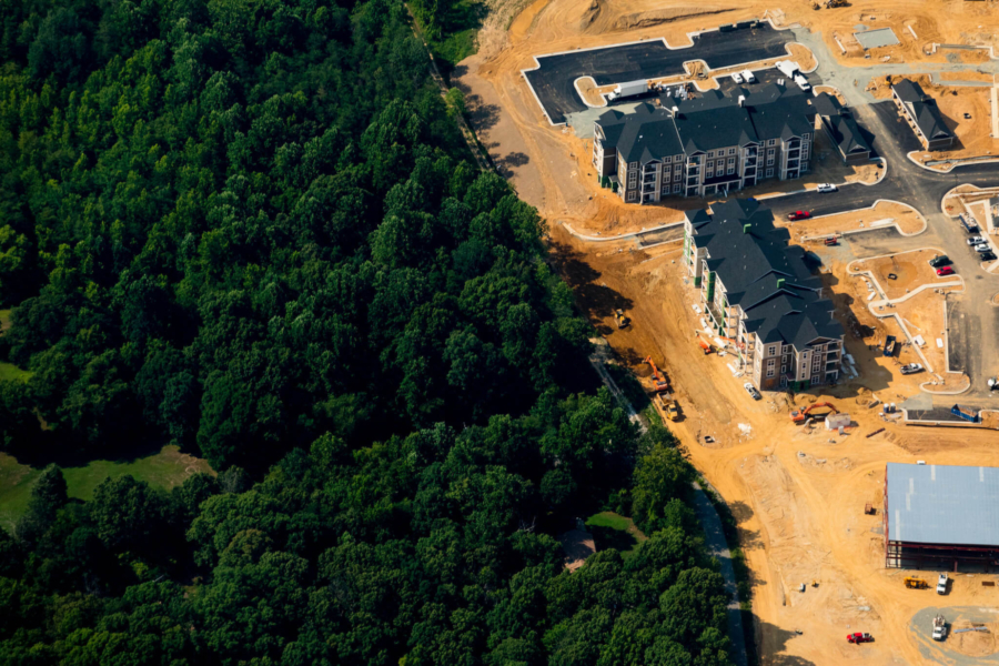
As populations expand beyond the footprint of densely populated urban areas, forests, farms and other valuable landscapes are replaced with homes, commercial shopping centers and industrial development. According to the State of Chesapeake Forests 2.0, the Chesapeake Bay watershed has lost nearly 100,000 acres of natural forests to developed or developing lands. The loss of forests means the loss of valuable habitat that can absorb air pollution, sequester carbon, capture rainfall, trap polluted runoff, mitigate flooding and provide food, shelter and safe migration paths for wildlife.
The loss of farmland can also impact the environment. Well-managed agricultural lands can minimize erosion, protect rivers and streams, provide habitat to insects, birds and mammals, and make the region less vulnerable to the effects of climate change. Agriculture is also an important part of the region’s economy and cultural heritage.
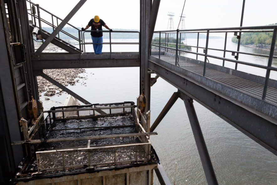
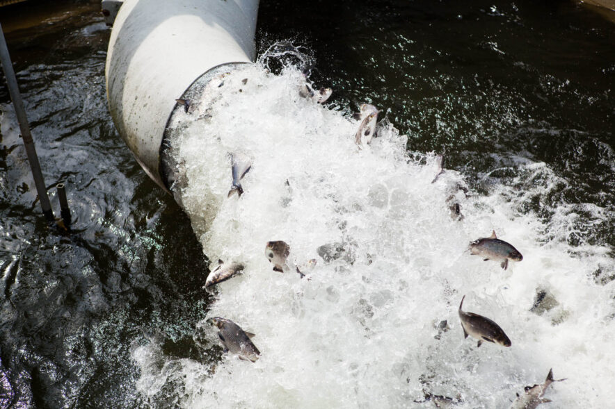
Blockages to the movement of fish
Development often leads to the construction of dams, reservoirs and culverts that can impact the Bay’s rivers and streams. Dams regulate river flow, reservoirs store water and culverts allow water to pass under roads. Though often necessary for a growing population, these constructions can disrupt the flow of water, increase the build-up of sediment and block the normal movement of fish, keeping them from finding food, escaping predation and migrating between freshwater and saltwater habitats.
For decades, Chesapeake Bay Program partners have worked to remove outdated fish blockages or install features that allow fish to maneuver past the structures. Since 1988, partners have opened more than 30,000 miles of rivers and streams to fish passage.
Sprawl and stormwater runoff
When residential and commercial areas are built far from existing cities and towns, new infrastructure—such as schools, roads and shopping centers—is built along with them. Over time, the once open areas between new and existing developments are filled in. This type of development, called sprawl, often replaces forests, wetlands and other vegetated areas with roads, parking lots and other paved or hardened surfaces. While natural landscapes absorb rainfall into the ground, impervious surfaces send stormwater directly into storm drains, rivers and streams, picking up nutrients, sediment and other pollutants along the way.
Increased wastewater
A larger population means more wastewater from homes, schools, businesses, industrial facilities and other areas. While wastewater treatment plants reduce the amount of harmful substances in wastewater before it is released back into rivers, streams and the Bay, some communities have outdated sewer systems and treatment plants that weren’t designed to handle large populations and increasingly heavy rainfall. This can lead to more nutrients and sediment washing into waterways.
How is land in the Chesapeake Bay region protected?
Putting land under protection is one way to ensure the watershed withstands population growth and sustains the plants, animals and people that live here. For decades, Chesapeake Bay Program partners have permanently protected lands with cultural, historical, ecological and agricultural value by holding easements, accepting land donations and purchasing properties and development rights. As of 2022, 9.16 million acres of land had been permanently protected.
How can you help?
To lessen the impacts of population growth and development on the Chesapeake Bay, consider how you can reduce the amount of polluted runoff flowing away from your home, school or business and into local rivers and streams. Install a green roof or rain garden to capture and absorb rainfall; use porous surfaces like gravel or pavers in place of asphalt or concrete; and redirect home downspouts onto grass or gravel rather than paved driveways or sidewalks.