Groundbreaking land cover data to support Chesapeake Bay restoration efforts
Available to public at no cost, data provides critical resource to governments, nonprofits

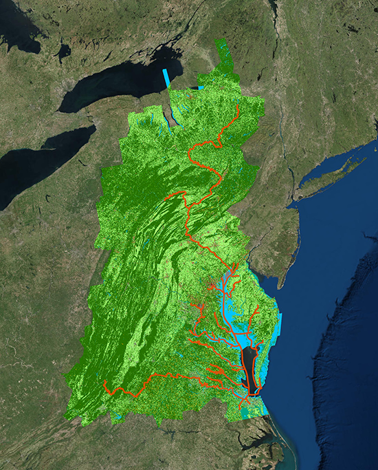
The Chesapeake Bay Program today announced the completion of the Chesapeake Bay High Resolution Land Cover Project, a landmark initiative to improve information about the features of the Bay watershed landscape. The new high-resolution data on land cover—such as buildings, tree canopy and water—will support the Bay Program’s efforts to evaluate progress toward reducing the amount of pollution flowing into the Chesapeake Bay.
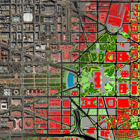
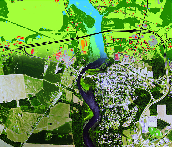
Chesapeake Conservancy—an Annapolis, Maryland-based nonprofit—led a partnership with the University of Vermont and Worldview Solutions, Inc. to complete the project, which is one of the largest high resolution land cover datasets in the nation. A team of geospatial analysts worked for ten months to produce one-meter by one-meter resolution land cover data for nearly 100,000 square miles, spanning the entire Chesapeake Bay watershed and surrounding counties. Offering an unprecedented degree of accuracy, the new dataset provides 900 times the amount of information as the existing watershed-wide data.
“The power of data behind the Chesapeake Bay High Resolution Land Cover Project cannot be overstated,” said Nick DiPasquale, Director of the Chesapeake Bay Program. “This is a technological snapshot, the likes of which we’ve never had before, of exactly how the land is being used across the entire watershed. Now restoration and conservation decisions can be made that more closely and accurately reflect real-world conditions.”
Available to the public at no cost, the high resolution land cover data will aid in the restoration and conservation work of federal, state and local government agencies, nonprofits, academic institutions and other organizations by allowing for better characterization and understanding of the landscape. In particular, the Bay Program will use the data to improve and refine its current suite of modeling tools, allowing for enhanced evaluation of progress in support of the 2017 Mid-Point Assessment of the Chesapeake Bay Total Maximum Daily Load (TMDL).
Comments
The Chesapeake Bays pollution problems may feel huge, complicated, and far away. But the people there are working to find solutions that places like Buzzards Bay may use to achieve progress to protect and restore our Bay and its coves, rivers, and harbors.
Thank you!
Your comment has been received. Before it can be published, the comment will be reviewed by our team to ensure it adheres with our rules of engagement.
Back to recent stories