Interactive StoryMap highlights the state of forests across the Chesapeake Bay watershed
Chesapeake Bay Program builds upon the 2006 report
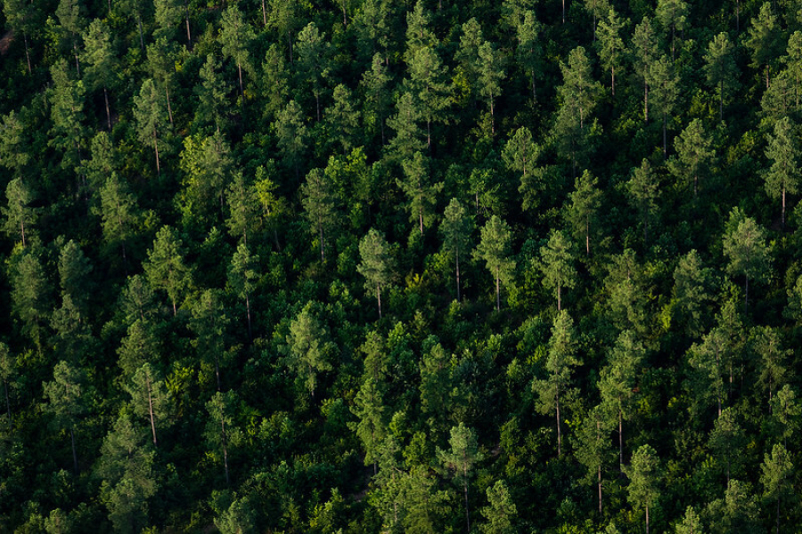
Forests are critical to sustaining the health of the Bay watershed, its wildlife, and the communities across the region. But as development continues to increase, tree loss is a mounting issue. Now, for the first time in over 15 years, the Chesapeake Bay Program is releasing a report detailing the state of forests across the watershed. Findings from the report—which include tree loss and growth, economic estimates, conservation recommendations and more—are summarized in an the interactive StoryMap titled State of Chesapeake Forests 2.0.
The new StoryMap builds off the original State of Chesapeake Forests report, which was released in 2006 by the Conservation Fund, with support from the U.S. Forest Service and the Chesapeake Bay Program. A notable addition to the new StoryMap is the use of high-resolution data developed within the Bay Program that illustrates how land is being used across the 64,000 square-mile watershed, including 206 counties. Based on this data, the StoryMap details the location of tree cover and forest throughout the region and how tree cover and forested areas are changing. Thanks to the rich land use dataset, the StoryMap distinguishes between different types of tree cover and forest, such as recently harvested forest, early successional forest, forest with mature tree cover, and tree cover in more developed landscapes.
Representing the full watershed, the StoryMap breaks down the proportion of trees and forests within each jurisdiction of the region, including detailed maps for each county. Local governments, practitioners, policymakers and more can use the StoryMap to gain a better understanding of how Chesapeake forests are changing and what that means for the health of our waterways.
Some of the key findings highlighted in the StoryMap include:
- Trees in the Chesapeake Bay watershed are providing over $6 billion in benefits annually from air pollution, reduced stormwater runoff, and carbon sequestration
- Although there are a lot of great tree-planting initiatives throughout the watershed, tree planting is not keeping pace with tree loss. Trees are being lost to development at an alarming rate: over 106,000 acres of tree cover were lost to development between 2013/14 and 2017/18
- This loss of tree cover has resulted in a reduction of over $871 million in benefits from air pollution removal, reduced stormwater runoff and carbon sequestration
Although forests and trees are under increasing threat, there are many opportunities to get involved with conserving and restoring Chesapeake forests. These include establishing community tree canopy goals, updating local codes and ordinances to encourage best practices for conservation, tree planting and maintenance and community engagement.
Future iterations of the StoryMap will be developed to add new data on riparian land use, plantable space in the watershed, forest fragmentation and tree equity.
The State of Chesapeake Forests 2.0 is a cross-partnership effort with involvement from federal and jurisdictional governments, nonprofits, and universities. The Land Use/Land Cover data supporting and the StoryMap itself would not have been possible without the cooperation of Bay Program Partners.
Comments
There are no comments.
Thank you!
Your comment has been received. Before it can be published, the comment will be reviewed by our team to ensure it adheres with our rules of engagement.
Back to recent stories