New buoys to track dissolved oxygen in the Bay every 10 minutes, top to bottom
Tracking dissolved oxygen helps us understand where wildlife is threatened
Scientists researching how areas of low dissolved oxygen in the Chesapeake Bay affect living resources will get a big boost this year in the form of significantly more data. The data will come from three stations, each including a buoy and sensors that will track dissolved oxygen levels, temperature and salinity at the surface and near the bottom of the Bay—as well as in the water in-between. These stations are a project of the Chesapeake Bay Program’s Hypoxia Collaborative and were funded by the Infrastructure Investments and Jobs Act.
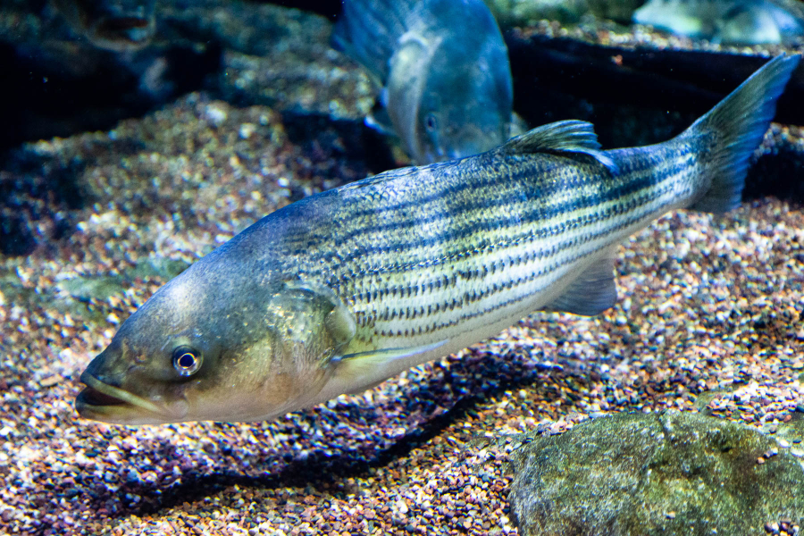
This data will help researchers learn more about how changes in the Bay’s hypoxic area (the volume of water with very low dissolved oxygen levels), temperature and salinity affect the distribution and abundance of different species. For example, every summer, striped bass face a “habitat squeeze” when waters near the surface of the Bay get too hot for them, but waters near the bottom don’t have enough oxygen for the fish to live there. They are forced to retreat to a slim slice of Bay waters in between the two layers. This means they have less space in which to find food and evade predators. Blue crabs also have to avoid low oxygen areas as they look for food and migrate to reproduce.
Learning more about where and when low dissolved oxygen happens will help resource managers make decisions that affect wildlife. The data will also be helpful as the Chesapeake Bay Program monitors water quality for many reasons—including for tracking progress toward its water quality goals.
A big step forward in monitoring
While the buoys and sensors will provide a huge step forward in tracking hypoxia, they are not the first effort to monitor dissolved oxygen in the Bay.
Working with the Maryland Department of Natural Resources and the Virginia Department of Environmental Quality, the Chesapeake Bay Program’s Tidal Water Monitoring Program tracks temperature, salinity and dissolved oxygen at more than 100 tidal mid-channel stations. At each location, data are acquired at roughly one- to two-meter intervals throughout the water column. But this data is gathered infrequently, roughly once each month.
The NOAA Chesapeake Bay Interpretive Buoy System tracks water temperature and salinity every six minutes—but only near the surface, and at a limited number of locations (as of early April 2023, seven locations).
But now, thanks to a partnership between the Environmental Protection Agency and the National Oceanic and Atmospheric Administration (NOAA), scientists will be able to use these new buoys to get data from throughout the water column every 10 minutes. It’s a novel way to tackle the issue of getting data both frequently and from throughout the water column.
How the buoys work

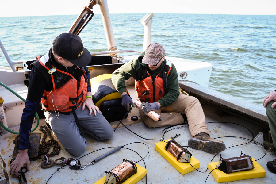
This spring, a team of scientists will deploy a set of sensors at three locations—at the mouth of the Choptank River, west of Hoopers Island and south of Point Lookout at the mouth of the Potomac River. The buoys and sensors will stay in the water, capturing data, through late fall.
At each location, a Soundnine Ulti-Buoy will be stationed that includes an onboard computer and cellular modem that allows data to be transmitted. The buoy will be anchored to the Bay bottom at that location using an inductive wire to which several sensors are attached. There will be a sensor one meter below the surface and then every two meters below that. Each sensor will monitor dissolved oxygen, temperature and salinity, and will send that information to the computer on the buoy. That computer will send data back to a database on shore every 10 minutes.
Test deployments of these buoys happened in 2022, and the scientists learned a lot not only about the robust datasets the buoys and sensors can gather, but about how frequently the buoys and sensors must be serviced to keep them running effectively. Especially during the summer, biological growth happens quickly, so teams must visit and clean the sensors every few weeks.
The goal is to have three to four stations this year, five to seven in 2024, and potentially 10 stations in 2025. Once the team is happy with how the data are flowing, the intention is to make data from these buoys available as part of the NOAA Chesapeake Bay Interpretive Buoy System website.
Comments
There are no comments.
Thank you!
Your comment has been received. Before it can be published, the comment will be reviewed by our team to ensure it adheres with our rules of engagement.
Back to recent stories