Maps
Browse through maps depicting Bay health and restoration, including pollution trends, public access sites and more.
Chesapeake Bay Mean Surface Salinity (1985-2018)
Date created: October 10, 2019The salinity of the waters in the Chesapeake Bay and its tidal tributaries varies from season to season and year to year depending largely on the amount of freshwater flowing into the Bay. The salinity of these tidal waters has an effect on such things as fish spawning habitat, underwater grass species distribution, oyster distribution and the likely distribution of the oyster-killing parasites Dermo and MSX.
View map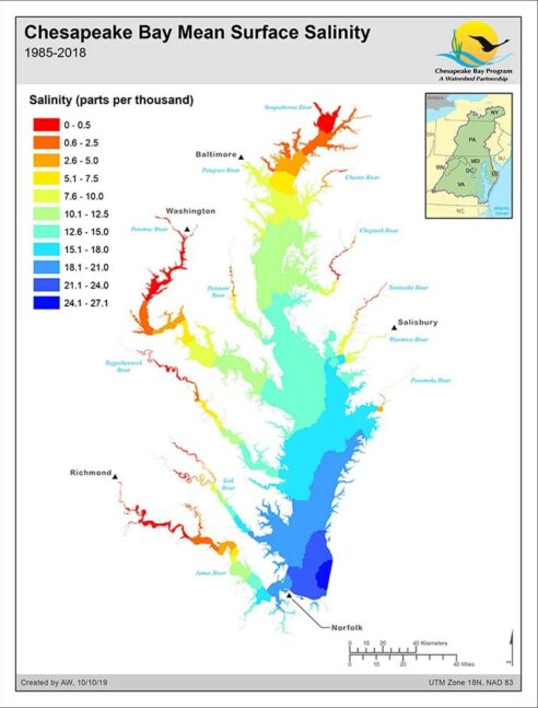
SAV Salinity Zones
Date created: April 21, 2014Up until 2013, submerged aquatic vegetation (SAV, also known as bay grasses) acreage totals for the Chesapeake Bay were aggregated into three zones: Upper Bay, Middle Bay and Lower Bay. For 2013, it was decided to report the totals by the four salinity zones found in the Bay: tidal fresh, oligohaline, mesohaline and polyhaline. Since different species of SAV are generally found in waters of a specific range of salinity, tracking changes in SAV abundance by salinity could help track changes in species abundance more easily.
View map