Maintain Healthy Watersheds Goal Implementation Team (GIT 4)

The Maintain Healthy Watersheds Goal Implementation Team works to keep local watersheds healthy across a range of landscapes, bringing attention to the challenge of protecting streams and watersheds that are healthy today and restoring waters if they become degraded. An updated map of State-Identified Healthy Waters and Watersheds and progress toward the Maintain Healthy Watersheds goal can be viewed at Chesapeake Progress
Upcoming Meetings
August 8, 2022
11:00 pm - 1:30 pm
Maintain Healthy Watersheds GIT Meeting, August 8, 2022
Download calendar file (.ics)Scope and Purpose
The goal of the Maintain Healthy Watersheds Goal Implementation Team (HWGIT) is to maintain local watersheds at optimal health across a range of landscape contexts. With this goal, the HWGIT intends to bring attention to the challenge of protecting streams and watersheds that are healthy today, as a programmatic complement to the “impaired waters” approach which focuses on restoring waters if they become degraded. Healthy watersheds sustain local social, economic, and environmental benefits at optimal levels and contribute to achievement of Chesapeake Bay Program goals for the tidal Chesapeake Bay and tributaries. The optimal levels at which such benefits are sustainable will depend upon the landscape context of the watershed.
The principle rational for setting the Healthy Watersheds goal is that balanced strategies for natural resource restoration, protection, investment, and management are necessary to achieve a sustainably restored Chesapeake Bay. Conserving natural resources is a more cost-effective strategy to achieve Chesapeake Bay water quality goals. In addition, maintaining healthy local watersheds is more meaningful to communities since the majority of citizens are more likely to be concerned about the health of their local streams than the Chesapeake Bay.
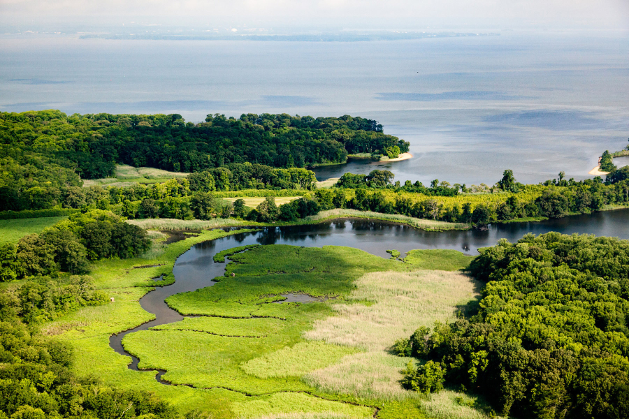
The HWGIT has identified four strategies to ensure the long-term conservation of healthy watersheds: 1) tracking the health of watersheds and our effectiveness in protecting them, 2) strengthening local commitment and capacity to protect healthy watersheds, 3) improving protection of state-identified healthy watersheds under federal programs and federal agency decision-making, and 4) supporting state-based efforts to improve assessment and protection of healthy watersheds.
Projects and Resources
Chesapeake Healthy Watersheds Assessment
In 2017, the EPA’s Healthy Watersheds Program published the results of their Preliminary Healthy Watersheds Assessments (PHWA), a project that brought together nationally consistent data to assess watershed health and vulnerability. The HWGIT agreed that a similar regional assessment utilizing jurisdiction specific data could address major gaps identified in the Healthy Watershed’s Management Strategy. Building on the PHWA framework, HWGIT contracted Tetra Tech to complete a Chesapeake Healthy Watersheds Assessment (CHWA) to help partners identify “signals of change” in vulnerable or resilient healthy waters and watersheds. The final report was published in 2019 and is available below. In order to visualize the results, Innovate!, Inc. developed an application to facilitate exploration of the data. The readily available online, geospatial tool supports and informs management related to watershed health and vulnerability at the catchment scale. See the flyer below to read more, and access the tool directly here.
-
Chesapeake Healthy Watersheds Assessment (4.25 MB)
-
Appendix B (11.32 MB)
-
CHWA Flyer (351.33 KB)
Map of State-Identified Currently Healthy Waters and Watersheds (2017)
The most current (2017) map of state-identified healthy waters and watersheds and the 2015 map. The Healthy Watersheds Outcome in the Chesapeake Bay Watershed Agreement states that one hundred percent of these waters and watersheds will remain healthy.
-
Map of State-Identified Healthy Waters and Watersheds (2017) and Protected Lands (2019) (319.38 KB)
-
Map of State-Identified Healthy Waters and Watersheds (2015) (1.58 MB)
Conservation Land-Use Policy Toolkit
This toolkit provides local governments in the Chesapeake Bay Watershed with information about land use policy tools they can use to slow the conversion of farmland, forestland, and wetlands.
-
Chesapeake Conservation Land Use Policy Final Report (5.31 MB)
-
Conservation Land Use Policy Toolkit Webinar (2.94 MB)
- Case Study Summary Tables (42.98 KB)
- Case Study Matrix (23.62 KB)
Healthy Watersheds Forest Retention Studies (Phases I, II and NEWLY released Phase III):
The Healthy Watersheds/Forest project is a Virginia-led, multi-year, landscape-scale effort begun in 2015 that is now in nearing completion in phase III. The goal of this project was to research and pilot alternative methods for forest and agricultural land conservation through three separate phases. Phase 1 modeled and tested alternative land use growth scenarios in a portion of the Rappahannock River Basin as a proxy for the Chesapeake Bay watershed by employing the methodology used by EPA TMDL modelers and using real land use data from the localities in the test area to determine the potential value of a BMP in the TMDL model for retaining forestland. In Phase II, Pennsylvania partnered with Virginia to determine what from the perspective of local leaders were the economic and policy incentives needed to prioritize forestland retention as a land use planning option. Phase III developed and piloted the community policy and financial infrastructure necessary to facilitate high quality forest and agricultural land conservation/retention on a sustainable, landscape scale basis. Phase III was divided into two tasks. Task 1 focused on collaborating with the municipal authorities responsible for the plans, policies and ordinances in the two pilot counties. Task 2 focused on developing a transferable financial model in the pilot counties to incentivize private capital markets to invest in the retention of forest and agricultural lands to offset future forecasted growth and development based on the 6.0 Chesapeake Bay Total Maximum Daily Load (TMDL) model. The ultimate goal has been to create a favorable regulatory environment and incentives for private landowner participation in land conservation while also contributing to the funding requirements of counties to help them meet basic services for their citizenry through a model that can attract private sector financial interest at a scale required to achieve the Phase III goal. This Phase III report covers the research, findings and activities from the start of phase III in April 2018 through September 30, 2019, the end-date for the Chesapeake Bay Trust-funded grant period. The focus of the project team from this point forward to the end the project next Spring (with additional funding from the US Endowment for Forestry and Communities) will be on (1) designing and testing in collaboration with Orange County Virginia, the Economic Development Authority infrastructure required to aggregate landowner interests effectively, and (2) further engaging with the private financial sector to solicit its interest in participating in the Virginia approach, while refining the financial options to best meet landowner, locality and investor needs.
You can read the final reports for each phase here:
-
Phase I Final Report (1.64 MB)
-
Phase II Final Report (6.8 MB)
-
Phase III Final Report (2.65 MB)
Summary Report: Potomac Watershed Assessment Methodology
The Nature Conservancy conducted a watershed assessment to delineate healthy watersheds in the Potomac watershed portion of West Virginia. This project was funded by the Maintain Healthy Watersheds GIT in 2014 and was completed in the fall of 2015. The methodology used was the same as the one applied in the West Virginia Watershed Assessment Pilot Project. As part of this project a comprehensive 39 metric index of overall watershed health was created.
Economic Benefits of Protecting Healthy Watersheds: A Literature Review
This paper explores the various methods that have been used to quantify the value of ecosystem services. Specifically, it examines payment for ecosystem service schemes, willingness to pay studies and cost avoidance scenarios. Cost avoidance scenarios, although generally considered to capture only the lower bounds of actual value, are used to communicate a clear message to society about the potential costs of losing an ecosystem service and replacing that service. Many case studies that examine the costs of replacing ecosystem services highlight the economic benefits of protecting healthy watersheds.
Approach to Chesapeake Bay Land Use Policy Tasks
Tetra Tech has developed an approach for (1) conducting surveys to identify policy options, incentives, and planning tools effective at reducing land conversion, (2) conducting a study to determine the range of existing policy options, incentives, and planning tools that are currently being implemented, and (3) creating an online repository of such examples to serve as a user-friendly knowledge base.
-
Land Use Policy Tasks Approach (644.93 KB)
-
List of Policy Options, Incentives, and Planning Tools to Reduce Land Conversion (205.44 KB)
Tracking Healthy Waters Protections in the Chesapeake Bay
A team of graduate students in the Thomas Jefferson Program in Public Policy at the College of William & Mary surveyed local government staff in 23 Chesapeake Bay Watershed localities in Maryland, Pennsylvania, and Virginia. Four categories of watershed protection tools were tested across all states: watershed management, zoning ordinances, development management, and natural resources protection. On average, localities utilized less than half of the policies categorized as watershed management and development management. Development management and natural resources protection policies were almost universally used. Local policies varied in their level of stringency and enforcement. A number of state regulations mandated the use of certain policies, and localities differed widely in their use of local regulatory authority to have more restrictive policies. The most successful localities blended mandates with incentives and advisory services, while gearing action and awareness specifically toward watershed protection.
-
Tracking Healthy Waters (2.57 MB)
Susquehanna River Basin Ecological Flow Management Study
As the single largest freshwater input to the Chesapeake Bay, the Susquehanna River is a key tributary to one of the nation’s most important estuaries. Natural hydrologic variability is a fundamental component of any river system’s ecological health. Aquatic species and natural communities have evolved in concert with naturally variable flows, and the ecological health of a river system depends on an intact hydrologic regime. This study is focused on ecological flow needs, often called environmental flows, and other water resource needs are not explicitly considered.
-
Susquehanna River Basin Ecological Flow Management Phase I Report (6.42 MB)
-
SRBC Ecological Flow Management Study Presentation: J. Balay (3.25 MB)
The Role of Natural Landscape Features in the Fate and Transport of Nutrients and Sediment
In response to a request from the Chesapeake Bay Program’s (CBP) Maintain Healthy Watersheds Goal Implementation Team (GIT4), the CBP’s Scientific and Technical Advisory Committee (STAC) sponsored a workshop on March 7-8, 2012 to consider whether there is a scientific basis for changing how the Chesapeake Bay Program Watershed Model assigns nutrient and/or sediment loading rates of natural landscape features based on their ecological health/condition, management status, and/or landscape position.
The workshop agenda included plenary sessions with expert panels on the fate and transport of nutrients and sediments by natural landscape features - forests, riparian buffers, streams, and wetlands – one panel on landscape ecology, and one presentation on how the current Chesapeake Bay Program Watershed Model estimates nutrient and sediment loading rates. Workshop participants then dispersed into breakout groups, one for each landscape feature, to discuss the following questions:
- What changes could be made to the existing Chesapeake Bay Program Watershed Model to better simulate the functioning of natural landscapes?
- What functions should be considered in any future modeling effort?
- What questions need to be addressed by the scientific community before any model or tool can appropriately simulate or account for natural landscape functions?
-
Healthy Waterhseds STAC Workshop Report (723.8 KB)
Publications
-
2021 Healthy Watersheds Presentation
-
2021 Healthy Watersheds LAP
-
2021 Healthy Watersheds Narrative Analysis