Tier II: Chesapeake Bay SAV Watchers Program
SAV Watchers is a volunteer-based program that supplements the Bay-wide aerial survey and provides community engagement opportunities
What is Chesapeake Bay SAV Watchers program?
The second tier of the Chesapeake Bay SAV Monitoring effort is the Chesapeake Bay SAV Watchers program. This is a volunteer-based effort coordinated by the Bay Program’s SAV Workgroup that provides community members with an educational experience while generating useful data for Bay scientists and resource managers. Volunteers collect information on SAV diversity and habitat characteristics at sites throughout the Bay and its tributaries and submit photos of their observations. These data are useful for broad-scale condition assessments and for identifying and quantifying driver-response relationships, such as improved water quality conditions resulting in SAV growth.
SAV Watchers Program Tutorial Videos
How can I be a Chesapeake Bay SAV Watcher?
The Chesapeake Bay SAV Watchers program welcomes anyone, but we differentiate data by the volunteer's expertise. There are three expertise levels. Each level is aimed at a different user group and represents a different level of monitoring intensity.
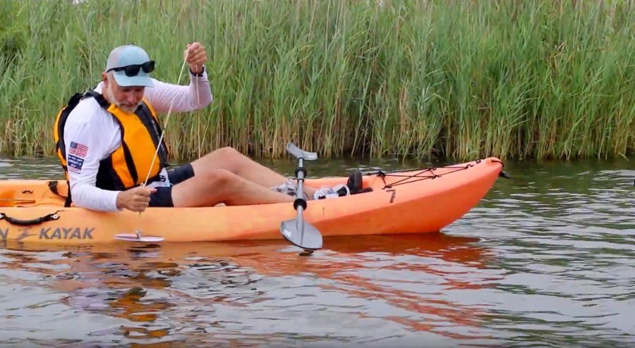
- Level 1 is designed for people who want to contribute SAV observations while they’re on the water, but have not received any formal training.
- Level 2 is more complex and is designed for volunteer scientists who want to monitor SAV as members of organized groups, such as with a Riverkeeper or other local watershed organization. If you aren’t currently part of an organized group but want to be, check out your local Riverkeeper program to find out if they have an SAV Watchers program in your area. Level 2 volunteers have attended a Chesapeake Bay SAV Watchers training event or have received training from a certified SAV Watchers Trainer. These volunteers should have more confidence in their ability to identify SAV and follow the SAV Watchers monitoring protocol than Level 1 volunteers.
- Level 3 is for certified SAV Watchers Trainers who lead organized groups, such as those with Riverkeepers or other local watershed organizations. Certified SAV Watchers Trainers are volunteers that have been tested on their knowledge in order to become proficient at SAV identification and the SAV Watchers monitoring protocol. Trainers should feel confident enough in their skills to teach others.
Observers without Training
Level 1 participants who would like to contribute to the Chesapeake Bay SAV Watchers program without training should use the ArcGIS Survey123 mobile app or website to upload photos of the SAV they observe while out on the water. Observers without training only need to fill out the required questions on the survey form.
Steps for uploading data:
- Download the ArcGIS Survey123 app.
- Tap "Continue without signing in."
- Tap the mini QR Code in the upper right corner.
- Scan the QR Code.

- Observe SAV in Chesapeake Bay and its tributaries and take photos
- Upload SAV photos to ArcGIS Survey123.
For each photo, volunteers identify, if possible, the SAV species present at their monitoring location and share the GPS coordinates of the site. Observations appear in and are stored online within an ArcGIS Online Map. It is important for level 1 participants to include pictures with their submissions so that SAV Watchers program leads can verify the species identification.
Observers with Training
Level 2 and 3 participants in the SAV Watchers Program monitor a wide variety of parameters related to SAV growth, diversity, and the surrounding habitat. Trained participants that collect more in depth data record their observations in the ArcGIS Survey 123 app OR on printed datasheets which are later entered into the ArcGIS Survey online and are shared with scientists for incorporation into the VIMS interactive map of SAV in the Chesapeake Bay.
Volunteer Monitor Resources
To learn more about the Chesapeake Bay SAV Watchers program, visit the Resources and Tutorials lists located on this page. Among them, you’ll find the following:
Chesapeake Bay SAV Watchers guides: The Guide to Submitting Observations includes all the instructions you’ll need to start making SAV observations using ArcGIS Survey123. The Methods Manual is much more expansive with several SAV monitoring resources including background information on SAV, guides for how to select sampling sites and take high-quality photos, and an SAV species key.
Datasheets: There is a printable datasheet available for trained volunteers, as well as a larger print version. The ArcGIS Survey is formatted to ensure easy transfer of observations made on datasheets to a digital format.
Tutorials: The tutorials are a series of informational and training videos that will show you how to measure each parameter listed in the monitoring program.
Field Guide: The pocket-sized field guide has all of the information you’ll need to start monitoring SAV while being conveniently small enough to stick in your pocket or attach to your life jacket.
Have a Question?
Contact Brooke Landry by email at brooke.landry@maryland.gov or by phone (410) 260-8629. For updates on the program sign up to the email newsletter here.
Resources
- Data Sheet
- Data Sheet (Large Print)
- Pocket Guide
- Guide to Submitting Data and Observations
- Chesapeake Bay SAV Watchers Methods Manual
Tutorials
- Introduction to Submerged Aquatic Vegetation
- SAV Recovery in the Chesapeake Bay
- Monitoring SAV in the Chesapeake Bay
- Materials Available for Chesapeake Bay SAV Watchers
- Secchi Depth
- Water Depth
- Total SAV Density
- SAV Species
- Epiphytes
- Other Macrophytes
- SAV Flowers and Seeds
- SAV at Surface
- Bottom Sediment
- Shoreline Type
- Visible Shoreline Erosion
- Marine Debris
- Other Human Impact