Tracking the health of Baltimore's hidden streams
Follow Blue Water Baltimore as they monitor water quality in the Jones Falls
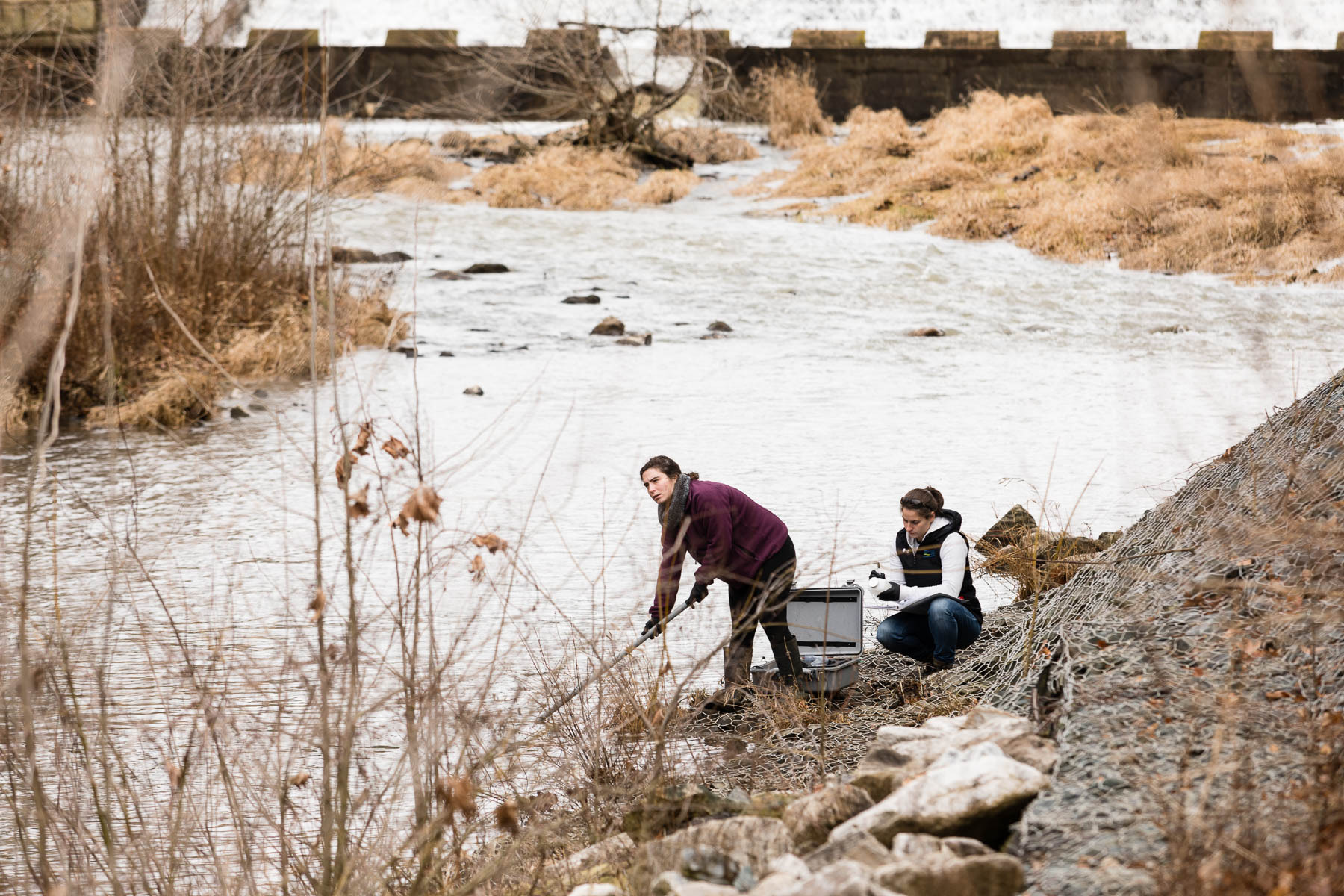
Standing at the edge of the Jones Falls, amid polystyrene coffee cups and plastic soda bottles, dwarfed by vibrant graffiti on the surrounding concrete walls, it’s almost possible to hear the rush of water over the noise of the nearby interstate and train tracks. It’s a mild January morning, and Alice Volpitta and Rose Dunn—armed with sensors and sampling bottles—are carefully perched on boulders next to the water.
The two are with Blue Water Baltimore, a nonprofit that once a month monitors water quality at sites along the Jones Falls and Gwynns Falls, two streams that run through the heart of Baltimore City. Today, Volpitta, Water Quality Manager, and Dunn, her volunteer monitoring intern, are visiting five sites along the downstream portion of the Jones Falls. It’s one less than the typical six, because a locked gate is blocking the path to one of the monitoring sites.
“There’s hardly any access to the water,” explains Volpitta. “It’s tough to actually get to it.”
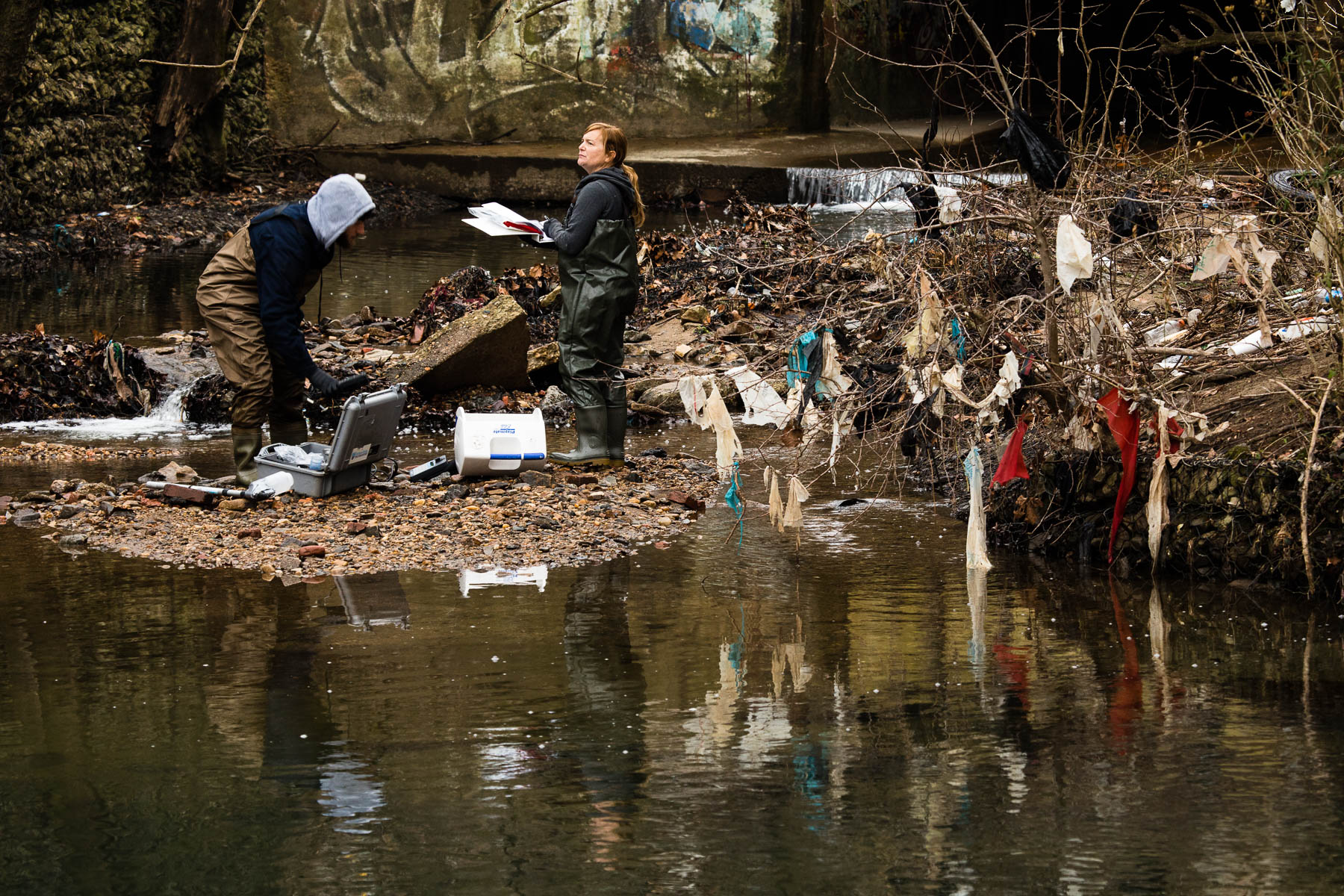
Locked gates aren’t the only obstacle: at various points along the five-stop route, the pair’s progress is slowed by steep, gravelly inclines; thick, viscous mud; and concrete barriers. “This is what I mean by lack of access,” Volpitta laughs at one site, as she and Dunn climb over the wooden railing of a staircase to get down to the water’s edge.
It’s the perfect illustration of how far-removed Baltimore can feel from the water. Apart from the tidal Patapsco River—which makes up the city’s Inner Harbor—Charm City seems mostly paved over. But amidst, and often beneath, the pavement sits a tangled network of streams, including the Jones Falls and Gwynns Falls.
“We’re only going to five sites, but you will see more of Baltimore streams today than most people will ever see,” says Volpitta.
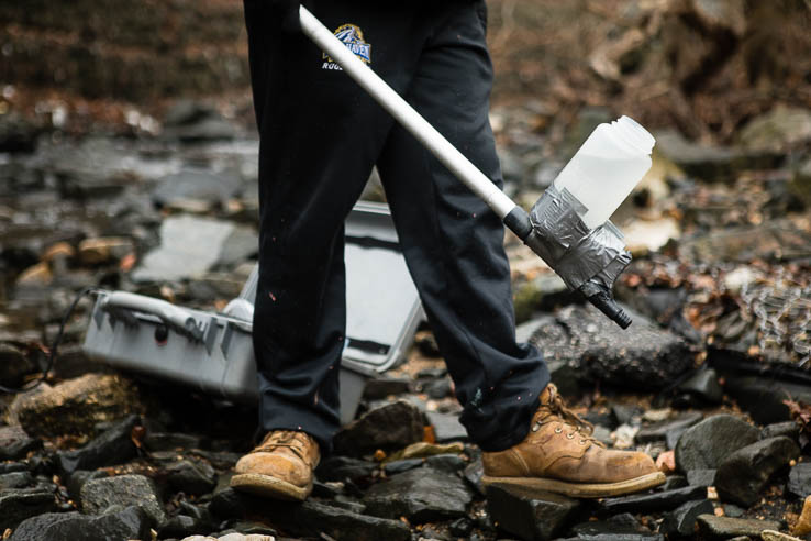
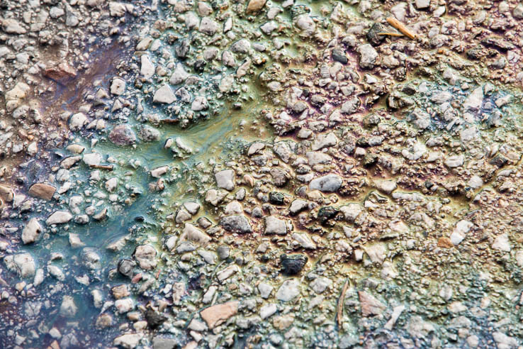
It’s what’s unseen in the water that Blue Water Baltimore is concerned with. The organization tracks a variety of measurements typical of water monitoring programs: nutrient and sediment pollution, dissolved oxygen, pH, temperature and conductivity. They also track levels of fecal bacteria, which waterways in the Baltimore region are infamous for—especially after a rainfall, and it had just rained the night before.
This means that, even if you find your way to the water’s edge, it can be best to adhere to a “look, don’t touch” policy.
“We never touch the water directly,” Volpitta explains. Each time they gather their sampling supplies and head down to a monitoring site, she and Dunn pull on pairs of disposable nitrile gloves.
Bacteria can reach the water in a few different ways. When rain falls on non-porous surfaces like roads, sidewalks or buildings, it’s unable to soak into the ground. Instead, it flushes away whatever it can from the surface—from leaking motor oil to pet waste—and rushes it to the nearest waterway. And with as much pavement as a city like Baltimore has, that can add up to a lot of pollution-laden water.
“There’s so much impervious surface in the city that every time it rains it just flash floods, basically,” says Volpitta. At one site, the cover of a sewer manhole had shifted, revealing an opening a few inches wide. The movement seems slight, but it was the result of hundreds of pounds of metal being lifted just by the force of rushing water.
Aside from polluted runoff, Baltimore’s aging water infrastructure plays a role in the presence of fecal bacteria in the Jones Falls. When it was first put in place, the city’s sewer system was state-of-the-art. But when rainfall overwhelms the now 110-year-old system, sewage can be directly discharged into the Jones Falls and other waterways.
The City of Baltimore is actively making repairs and upgrades to the system, but with more than 3,000 miles of sewer lines—some of which are cracked, clogged or simply too small to accommodate the necessary amount of water—progress has been slower than some had hoped for.
In 2002, repeated sewer overflows led the U.S. Environmental Protection Agency (EPA) and Maryland Department of the Environment to sue the City of Baltimore. As part of a settlement, the city agreed to fix the sewer system by 2016. Last year, this agreement was revised, giving the city until 2021 to stop its sewage discharges into the Jones Falls and until 2030 to complete all repairs the sewer system requires.
At one monitoring station—near Lake Roland, a former Baltimore City reservoir—it’s easy to forget how close you are to downtown. The loudest noise is the piercing rattle of a belted kingfisher as it flits from tree to tree, followed by the soft murmurs of visitors walking their dogs along the wooded pathway. It’s almost serene enough to persuade you that the water seems less polluted.
But that day, the fecal bacteria count at the Lake Roland site was 260 colonies per 100 milliliters of water. For reference, 151 is considered safe for limited contact with the water, and 61 is considered the safe threshold for full-body contact with the water.
Due in part to the rainfall the night before, none of the sites sampled that day had safe levels for human contact.
All of the monitoring data collected by Blue Water Baltimore undergoes a quality control check before being posted on Harbor Alert, which offers the most recent monitoring data for each site. Data is run through an algorithm to see if it’s safe to swim in the water, and each site is given a red, yellow or green indication of safe contact. In 2015, none of the sampling sites along the Jones Falls or Gwynns Falls were safe for swimming more than 60 percent of the time.
Each year, all the data collected is rolled up into the Waterfront Partnership’s Healthy Harbor report card, which last year gave Baltimore’s streams a grade of D-minus (the Inner Harbor and other tidal waters received an F).
Although plenty of work lies ahead, Volpitta and her colleagues remain focused on the long-term goal: healthy Baltimore waterways.
“I think it’s safe to say that Blue Water Baltimore, and for myself personally, we all are really looking forward to a future where we have swimmable and fishable waterways,” Volpitta says. “Sometimes people think that that term ‘swimmable and fishable’ is a pie in the sky, it’s never going to be attainable. But that’s a phrase directly from the Clean Water Act. So if our legislators thought it was good enough for the Clean Water Act, I think it’s good enough for Baltimore City.”
To view more photos, visit the Chesapeake Bay Program Flickr page.
Comments
There are no comments.
Thank you!
Your comment has been received. Before it can be published, the comment will be reviewed by our team to ensure it adheres with our rules of engagement.
Back to recent stories