From the fish kills to Conowingo Dam, USGS investigates the Bay watershed’s most complex issues
USGS Chesapeake Bay Coordinator weighs in on the agency’s achievements
Having served as the U.S. Geological Survey (USGS) Chesapeake Bay Coordinator for nearly 30 years, Scott Phillips has been privy to countless projects that have helped to protect and improve the Chesapeake Bay and its watershed. The USGS became an official partner of the Chesapeake Bay Program in 1984, just a year after the partnership was formed, serving as one of its leading scientific agencies. The USGS’s work in the Bay watershed has grown from a few water quality monitoring projects to an integrated effort addressing toxic contaminants, reducing pollution, changes in the watershed’s geography and the health of our wildlife.
We interviewed Phillips, who retired in March, to learn more about the USGS’s contributions to the Chesapeake Bay Program. While there are many highlights to choose from, here are 10 that stand out.
(1979) Establishing monitoring on the Bay’s largest tributaries.
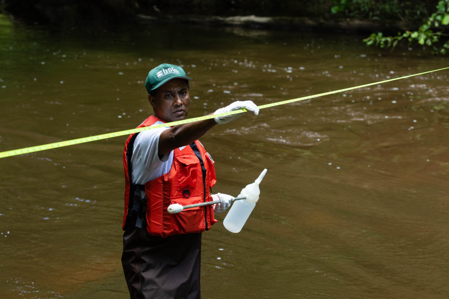
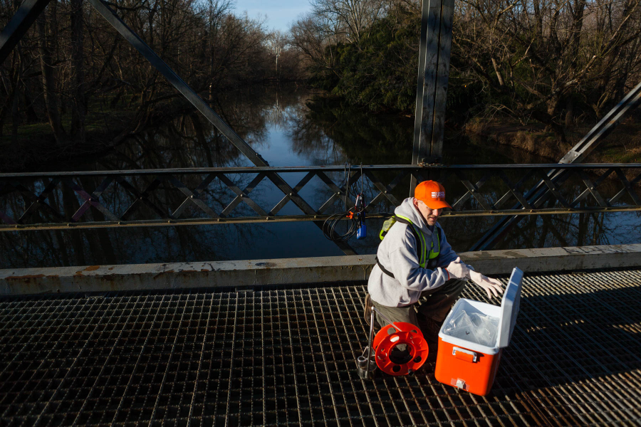
Monitoring of the three largest rivers entering the Bay (Susquehanna, Potomac and James) was established in 1979 through a partnership between the USGS, Maryland Department of the Environment and Virginia Department of Environmental Quality. During the mid-1980’s the monitoring was expanded to the nine major rivers entering the Bay, which continues today with our River-Input Monitoring (RIM) program. The RIM program provides foundational information on the amount of nutrient and sediment pollution that is entering the Bay, as well as helps us assess changes in the estuary’s health.
(mid-1990’s) Expanding monitoring throughout the entire watershed.
As the Chesapeake Bay Program grew, it became apparent that we needed a coordinated monitoring effort not only in the tidal portions of the estuary, but across the entire watershed. For two years in the mid-1990’s, the USGS collaborated with Maryland, Virginia, Pennsylvania, Washington, D.C. and the Environmental Protection Agency (EPA) to establish the Non-Tidal Monitoring Network. This network folded in existing monitoring stations and added new ones to ensure they were using compatible field collection methods and lab protocols. Starting with 50 sites across the watershed, the network grew during the 2000s, but took a major jump during 2011 and 2012 when the Chesapeake Bay Total Daily Maximum Load (Bay TMDL) went into place. The EPA supported an expansion from 85 sites to 120 so that that USGS could assess the water-quality response to the pollution reduction made from the Bay TMDL.
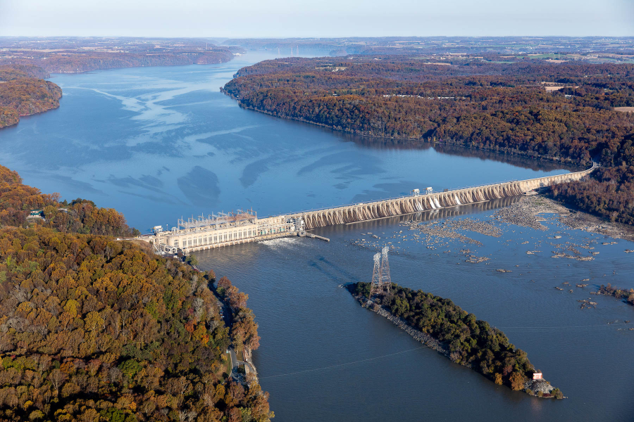
(1997) Identifying the extent of nutrient and sediment pollution being trapped at the Conowingo Dam.
Since the 1990s, the USGS has been closely monitoring the Conowingo Dam, which has a reservoir that traps nutrient and sediment pollution from flowing into the Chesapeake Bay from the Susquehanna River. In 1997, USGS released a report showing that the dam was trapping about 2% of the nitrogen, 45% of the phosphorus and 70% of the sediment transported by the river to the upper Chesapeake Bay. This was a good thing at the time—but in the same study, USGS predicted that within 20 years the dam would reach capacity and that those pollutants would start regularly flowing into the Bay. Follow-up studies revealed that between 1996 and 2011, there was a 55% increase in phosphorus and 97% increase in sediment coming to the Bay from the Susquehanna because of the Conowingo Dam.
(2003) Identifying a lag-time in pollution reduction.
In 2003, USGS research found that about half the water entering streams across the watershed was from groundwater. The age of the groundwater ranged from recent to over 50 years old, with an average of about a decade. This meant that we could expect a between when restoration work is done and when visible improvements in water quality can be seen, because those streams are still being fed by groundwater carrying decades-old nutrients.
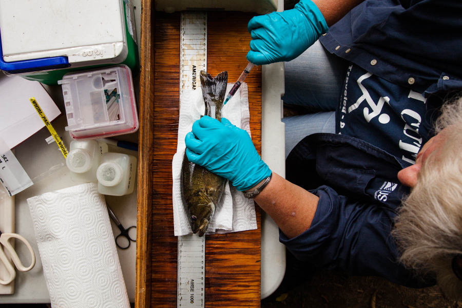
(2004) Discovering intersex conditions in fish from the watershed.
Following an increase in fish kills in the Potomac River watershed, the USGS began studying the health of freshwater fisheries in this area. During this research they discovered fish with intersex conditions (where male fish had eggs), which was the first time that this phenomenon had been seen in the Chesapeake Bay watershed. Follow-up investigations from the USGS and partners revealed additional signs of declining fish health, including lesions and ulcers. Studies identified multiple factors contributing to poor fish health and kills, including parasites, endocrine-disrupting chemicals and disease. This research, along with additional studies, helped inform the Toxic Contaminants Goal in the most recent Chesapeake Bay Watershed Agreement.
(2007) Linking DDT bans to bald eagle and osprey recovery.
In the 1970’s and 1980’s, jurisdictions across the Chesapeake Bay watershed banned the use of chlorinated pesticides (such as DDT) because of its suspected impact on wildlife. In 2007, a USGS synthesis proved that these actions led to the recovery of many fish-eating birds in the region, including bald eagles and ospreys. However, concentrations of other contaminants, such as Polychorinated Biphenyls (PCBs) in wildlife, were unchanged and remain a concern.
(2009-2010) Focusing agricultural conservation efforts.
The 2008 Farm Bill included unprecedented funding to accelerate conservation efforts on farms in the Chesapeake Bay watershed. To best allocate this funding, the USGS collaborated with the EPA and the U.S. Department of Agriculture National Resource Conservation Service to identify parts of the Bay watershed where agricultural practices to reduce pollutants were most needed. The “priority agricultural watersheds” have been updated over time and are still used to focus restoration efforts to reduce nutrients and sediment entering the Bay and improve the local water quality near those farms.
(2015) Addressing new priorities in the 2014 Chesapeake Bay Watershed Agreement.
With the signing of the most recent Chesapeake Bay Watershed Agreement, all jurisdictions in the Bay watershed and federal partners committed to a wide range of goals related to fish and wildlife, toxic contaminants, land conservation, water quality and more. The USGS evolved its science efforts to support many of these goals with new monitoring and research. In 2020, the USGS further evolved its efforts to help the partners better target where to focus and accelerate restoration and conservation efforts across the watershed that would help in meeting the targets of the Watershed Agreement goals.
(2015) Identifying 301 different types of chemical compounds in the Bay watershed
In 2015, the USGS began a series of studies on chemical compounds that cause birth defects and tumors in fish. Of the 301 compounds analyzed in 370 surface-water samples, 109 (36%) were observed at least once. The compounds detected included eight hormones, 27 pesticides, 25 pharmaceuticals, 38 organic waste indicator compounds and 11 phytoestrogens and mycotoxins. The research conducted by the USGS and subsequent efforts from Chesapeake Bay Program partners significantly increased our understanding of how chemical contaminants impact fish and what can be done to mitigate these effects.
(2016) Releasing unprecedented data on how land is being used in the Bay watershed
In 2016, the Chesapeake Bay Program released groundbreaking land cover data to support its restoration efforts. Working alongside the Chesapeake Conservancy, the USGS played a key role in this project, using aerial imagery and information from local land records to develop the most detailed set of land use data that had ever existed. This datatset was updated in 2022 when the Chesapeake Bay Program released an even more detailed assessment of how land has changed and is being used in the watershed. The data is anticipated to be updated every four years.
As the Chesapeake Bay Program celebrates our 40th anniversary, we are excited to highlight partners such as the USGS. Even with Scott moving on, the USGS will continue providing world-class science that guides the restoration of the Bay watershed. More information on USGS activities in the Chesapeake Bay watershed can be found at: Chesapeake Bay Activities | U.S. Geological Survey (usgs.gov)
Comments
Can the contaminated sediment behind Conowingo Dam be dredged? Can a more efficient fish passage way be installed at Conowingo Dam to allow Shad migration upstream? The fish lift at the dam is inefficient in moving adequate numbers of shad and other migrating fish species to additional spawning grounds up the Susquehanna River and the many tributaries.All other dams on the Susquehanna in Pennsylvania must follow with more efficient fish passageways plus enforce better water quality discharges to control medications , chemicals, pesticides, etc in the water effecting all aquatic life, wildlife and human health.
Thank you USGS for all of your work to improve our fisheries here in the Chesapeake Bay Watershed!
Thank you!
Your comment has been received. Before it can be published, the comment will be reviewed by our team to ensure it adheres with our rules of engagement.
Back to recent stories