Weather continues to impact Chesapeake Bay water quality
Weather continues to impact Chesapeake Bay water quality
The Chesapeake Bay Program announced today that an estimated 33% of the Chesapeake Bay and its tidal tributaries met water quality standards attainment during the 2017—2019 assessment period. This score is lower than the previous assessment period (2016—2018), when Bay water quality standards attainment was estimated to be 38%. Experts mainly attribute this decline to unusually wet weather in 2018 and 2019. The Chesapeake Bay Program strives to reach 100% attainment of water quality standards to support the survival, growth and reproduction of aquatic species important to a healthy Bay. Currently, 67% of the Chesapeake Bay and its tidal waters are likely to be impaired.
The Chesapeake Bay Program evaluates water quality standards attainment using three parameters: dissolved oxygen, water clarity or underwater grass abundance, and chlorophyll a (a measure of algae growth). Over the period of 2017—2019, a decline in dissolved oxygen was noted in the deep water (depths between 15—50 feet) and deep channel habitats (depths between 50—175 feet) of the Bay, compared to the previous assessment period (2016-2018). It is believed these declines are directly caused by short-term fluctuations in weather and the river flows that occur as a result. Generally, when the watershed receives more rain, river flows increase, bringing more nitrogen, phosphorus and sediment pollution into the Bay, leading to increased algae growth and a decline in dissolved oxygen.
Water quality in the Chesapeake Bay and its tidal tributaries is heavily influenced by nitrogen, phosphorus and sediment pollution delivered from the watershed and can vary year-to-year due to a number of factors including land use, fertilizer and manure use, wastewater and septic discharges, and river flow. The seven watershed jurisdictions (Delaware, the District of Columbia, Maryland, New York, Pennsylvania, Virginia and West Virginia), in coordination with local governments, businesses, non-governmental organizations and individuals have installed pollution-reducing practices to lower the amount of nitrogen, phosphorus and sediment entering waterways. However, management actions taken to decrease pollution from point sources (e.g., wastewater treatment plants) may immediately show detectable pollution changes, but in regard to the implementation of conservation practices for nonpoint sources, there is often a time lag (e.g., years to decades) in measuring their impact on improving water quality and the health of the Bay.
The conservation practices reported by the seven watershed jurisdictions, along with land use and manure and fertilizer information, are entered into a sophisticated suite of modeling tools to estimate the progress that each jurisdiction is making in meeting their individual nitrogen, phosphorus and sediment pollutant reduction goals as outlined in the Chesapeake Bay Total Maximum Daily Load (Bay TMDL).
According to these computer simulations, pollution controls put into place between 2009 and 2020 are estimated to have lowered overall nitrogen by 13%, overall phosphorus by 14% and sediment by 4%. Over this time period, it is believed that nitrogen and phosphorus reductions came primarily from improvements to wastewater treatment facilities throughout the watershed and efforts from the agricultural sector have helped to lower sediment.
Through the Chesapeake Bay Watershed Agreement, the Chesapeake Bay Program has committed to having in place 100% of the conservation practices that would achieve all of the nitrogen, phosphorus and sediment reductions necessary to meet the goals outlined in the Bay TMDL by 2025. As of 2020, conservation practices are currently in place to achieve 47% of the nitrogen reductions, 64% of the phosphorus reductions and 100% of the sediment reductions.
Facts
The U.S. Geological Survey (USGS) works with jurisdictional partners to monitor nitrogen, phosphorus and sediment pollution entering the Chesapeake Bay from the nine RIM stations. This monitoring data reflects the nitrogen, phosphorus and sediment pollution delivered to the Bay from almost 80% of its watershed. Pollution is estimated from the remaining 20% of the watershed by water samples collected at wastewater treatment plants, computer-simulated estimates of nitrogen and phosphorus pollution from nonpoint sources and computer-simulated estimates of air deposition of nitrogen to tidal waters. The USGS also determines long-term and short-term trends in nitrogen, phosphorus and sediment and works with Chesapeake Bay Program partners to collect monitoring data at more than 100 nontidal monitoring stations to assess the Bay’s response to a reduction in agricultural and urban runoff.
Each year, the seven watershed jurisdictions report the steps they have taken to reduce nitrogen, phosphorus and sediment pollution from entering the rivers and streams that flow into the Chesapeake Bay to the Environmental Protection Agency. Chesapeake Bay Program experts then run this information through the Watershed Model to estimate how far its partners have come toward meeting the pollutant reductions goals outlined in the Chesapeake Bay Watershed Agreement and the Bay TMDL. Chesapeake Bay Program partners have committed to having 100% of the practices that would achieve all of the nitrogen, phosphorus and sediment reductions necessary to meet the Bay’s clean water goals in place by 2025. The 2020 estimates were generated through the Chesapeake Assessment and Scenario Tool 2019 (CAST-2019) version of the Watershed Model.
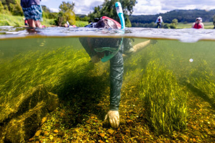
Water quality in the Chesapeake Bay and its tidal tributaries is influenced by nitrogen, phosphorus and sediment pollution delivered from the watershed and varies year-to-year due to a number of factors including land use, fertilizer and manure use, wastewater and septic discharges, and river flow. It is evaluated using three parameters: dissolved oxygen, water clarity or underwater grass abundance, and chlorophyll a (a measure of algae growth). These parameters are measured at hundreds of stations across the Chesapeake Bay and its tidal tributaries by the Maryland Department of Natural Resources, the Virginia Department of Environmental Quality and the District Department of Energy and Environment. The resulting data is used to develop an indicator of the estimated attainment of a set of water quality standards that can be monitored at this time. If the Bay and its tidal tributaries are to function as a healthy ecosystem, all water quality standards for all tidal aquatic habitats must be met.
Issues
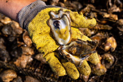
Excess nitrogen, phosphorus and sediment are among the leading causes of the Bay’s poor health. Nitrogen and phosphorus can fuel the growth of algae blooms that lead to low-oxygen “dead zones”. These conditions can suffocate plant and animal life and reduce the habitat that is available to them. Sediment can block sunlight from reaching underwater grasses and bury shellfish.
Importance
By incorporating the best available data into our computer simulations and pollution estimates, the Chesapeake Bay Program can more accurately track partners’ progress toward their pollutant reduction goals. These data give state agencies and local leaders the science-based information they need to assess their conservation practices and adapt their management decisions as needed.
Tracking the progress that each jurisdiction is making toward reducing nitrogen, phosphorus and sediment pollution entering not only the Chesapeake Bay, but also their local waterways, is helping to improve overall water quality, restore habitats and increase the populations of many plant and animal species. A more accurate picture of pollution in the watershed provides an overall more thorough understanding of how the actions that are being taken to restore water quality moves the partnership forward toward an environmentally and economically sustainable Chesapeake Bay.
Quotes
“We appreciate the work of our partner jurisdictions and local communities as they take actions to reduce pollution to local waters and the Bay. EPA will continue to provide substantial financial and technical support to close the gap in meeting goals while increasing the percentage of rivers and streams meeting water quality standards. EPA and its partners are committed to tackling climate change and countering the impacts it has on the Bay.”
- Diana Esher, Acting Regional Administrator, Environmental Protection Agency, Mid-Atlantic Region
“While we are making progress in achieving the water quality standards of the Bay, it is important that all Chesapeake Bay Program partners prioritize and quicken the pace of funding, technical assistance, the adoption of conservation practices at the local level and updating the science and models that support our decision support tools. Only then will we meet the 2025 Watershed Implementation Plan Outcome of having all practices in place to meet our pollutant reduction targets.”
- Ed Dunne, Chief, Standards and TMDL Branch, Water Quality Division, Department of Energy and Environment, District of Columbia and Co-Chair, Chesapeake Bay Program Water Quality Goal Implementation Team
“The monitoring and associated analysis done by multiple Chesapeake Bay Program partners is the foundation for assessing progress in restoring water quality conditions in the Bay.”
- Scott Phillips, Chesapeake Bay Coordinator, U.S. Geological Survey and Co-Chair, Chesapeake Bay Program Science, Technical, Assessment and Reporting Team
Recent Press Releases
Annual Chesapeake Bay Awareness Week celebrates a watershed “Built by Nature, Protected Together”
A mild dead zone is expected for the Chesapeake Bay this summer
Chesapeake Bay Program Provides Final Snapshot of Progress Under 2014 Watershed Agreement