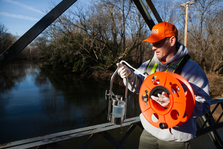
Water Quality Goal Implementation Team (GIT 3)

The Water Quality Goal Implementation Team works to evaluate, focus and accelerate the implementation of practices, policies and programs that will restore water quality in the Chesapeake Bay and its tributaries to conditions that support living resources and protect human health.
Upcoming Meetings
January 25, 2021
1:00 pm - 4:00 pm
Water Quality Goal Implementation Team Conference Call, January 25, 2021
Export this Event >>February 22, 2021
1:00 pm - 4:00 pm
Water Quality Goal Implementation Team Conference Call, February 22, 2021
Export this Event >>March 22, 2021
1:00 pm - 4:00 pm
Water Quality Goal Implementation Team Conference Call, March 22, 2021
Export this Event >>Scope and Purpose
The charge of the Water Quality Goal Implementation Team (WQGIT) is to evaluate, focus, and accelerate the implementation of practices, policies, programs that will restore water quality in the Chesapeake Bay and its tributaries to conditions that support living resources and protect human health. The Team reports to the Management Board and Principals’ Staff Committee. Functions include:
- Provide a forum for discussion, exchange of information, and evaluation among federal, state, and local agencies, river basin commissions, industry groups, universities, and other interested parties on water quality goals, data, modeling, authorities, and restoration efforts.
- Evaluate and promote strategies to reduce nutrient, sediment, and chemical contaminant loads from municipal, industrial and onsite wastewater; agricultural lands and animal operations; urban and suburban stormwater; forested lands; tidal and in-stream sediment; and air emissions.
- Promote consistent, uniform and transparent processes to model, track, report, and verify water quality restoration efforts.
- Identify, define, quantify, and incorporate pollutant reduction and conservation practices into the Chesapeake Bay Program decision support system.
- Provide technical expertise and leadership to support the development, implementation, and tracking of the Chesapeake Bay TMDL, Watershed Implementation Plans, and two-year milestones that support long-term Bay restoration goals.
Projects and Resources
Chesapeake Bay Watershed Data Dashboard
The Watershed Data Dashboard is a visualization tool to consolidate and provide accessibility to Chesapeake Bay watershed monitoring, modeling, trends, projections and explanations for use in watershed management planning and implementation.
Access the WIP Data Dashboard here: https://gis.chesapeakebay.net/wip/dashboard/
Multiple Benefits of Nutrient and Sediment BMPs
Jurisdictions and planners are encouraged to consider additional benefits of BMPs beyond nutrient and sediment load reductions in development and implementation of the Phase III WIPs. The following resources are available in this effort:
A co-benefits scoring report was developed to provide a scoring matrix for additional benefits from BMP implementation. The report and scoring matrix were used in the development of 12 Principles for Phase III WIPs fact sheets describe the co-benefits that are possible when BMPs are selected in a thoughtful manner with site-specific conditions in mind. Each includes contact information for each watershed jurisdiction for more information.
These resources are also available for download through CAST: http://cast.chesapeakebay.net/Documentation/DevelopPlans
Additional resources for the Phase III WIPs are available on the Phase III WIP Tools web page.
-
BMP Impact Scoring Report (Approved 4/21/17) (956.02 KB)
- BMP Impact Scoring Report Appendix D (Literature List) (35.36 KB)
- BMP Impact Scoring Report Appendix E (final impact scores matrix) (260.31 KB)
- BMP Impact Scoring Tool (410.58 KB)
-
WIP III Fact Sheet: Brook Trout (972.94 KB)
-
WIP III Fact Sheet: Climate Resiliency (706.64 KB)
-
WIP III Fact Sheet: Fish Habitat (750.35 KB)
-
WIP III Fact Sheet: Forest Buffers (148.58 KB)
-
WIP III Fact Sheet: Healthy Watersheds (497.72 KB)
-
WIP III Fact Sheet: Protected Lands (693.54 KB)
-
WIP III Fact Sheet: Public Access (692.69 KB)
-
WIP III Fact Sheet: Submerged Aquatic Vegetation (SAV) (844.84 KB)
-
WIP III Fact Sheet: Stream Health (584.09 KB)
-
WIP III Fact Sheet: Toxic Contaminants (687.63 KB)
-
WIP III Fact Sheet: Tree Canopy (138.17 KB)
-
WIP III Fact Sheet: Wetlands (441.71 KB)
Phase 6 Model and Midpoint Assessment
This project page is the repository for the Phase 6 model, its documentation, as well as files and links to Tableau pages. Please email Kyle Hinson (khinson@chesapeakebay.net) with any questions you may have.
Documentation
All documentation files will be uploaded to this FTP site to assist in partnership review of Phase 6: ftp://ftp.chesapeakebay.net/modeling/Phase6/Draft_Phase_6/Documentation/
Calibration
A summary PDF of calibration results has been generated and is available for download (large file): ftp://ftp.chesapeakebay.net/modeling/Phase6/Draft_Phase_6/Watershed_Model/WSM_Outputs/Calibration_Figures/00_Calibration_Figures_All_Phase6Draft.pdf
Other detailed calibration results for each calibrated parameter and river segment can be found in a separate FTP folder: ftp://ftp.chesapeakebay.net/modeling/Phase6/Draft_Phase_6/Watershed_Model/WSM_Outputs/Calibration_Figures/
Further detailed calibrated output for the watesrhed can be found in csv files located at this FTP site: ftp://ftp.chesapeakebay.net/modeling/Phase6/Draft_Phase_6/Watershed_Model/WSM_Outputs/Summary_Loads/
Further comparisons between the Watershed Model and WRTDS can be found at the non-tidal dashboard. These visual representations show both the loads estimated from monitoring data (WRTDS) and loads estimated from the Draft Phase 6 Model: http://cast-beta.chesapeakebay.net/documentation/NonTidalWaterQualityDashboard
Land use files can be found at this ftp site: ftp://ftp.chesapeakebay.net/Modeling/Phase6/Draft_Phase_6/Land_Use/
Watershed Model Inputs
Links to the sites for Watershed Model Inputs can be found at these web pages:
FAQ regarding Modeling Tools: https://mpa.chesapeakebay.net/Phase6FAQ.html
Graphical Interface for Phase 6 Model Inputs: https://mpa.chesapeakebay.net/Phase6DataVisualization.html
CAST Homepage: http://cast.chesapeakebay.net/
Phase 6 Soil Phosphorus Figures: ftp://ftp.chesapeakebay.net/Modeling/soil-p-history/fig/
Model Review Process
The process by which the partnership can most effectively submit comments and provide feedback to the development of the Phase 6 model will be outlined in a continuously updated document found below. The schedule of upcoming webinars is also provided below and in the attached document. Please contact Lewis Linker (llinker@chesapeakebay.net) or Kyle Hinson (khinson@chesapeakebay.net) with any questions.
Phase 6 Sediment Simulation Webinar: April 19, 2017, 1 PM - 3 PM (link) (recording)
Phase 6 Integrated Models and Decision Framework Overview Webinar: May 9, 2017, 1 PM - 3 PM (link) (recording)
Phase 6 Poultry Inputs Webinar: May 24, 2017, 1 PM - 3 PM (link) (recording)
Phase 6 Inputs Webinar: May 25, 2017, 1 PM - 3 PM (link) (recording)
Phase 6 Loads Webinar: June 1, 2017, 1 PM - 3 PM (link) (recording)
Phase 6 Physical Transport Webinar: June 20, 2017, 1 PM - 3 PM (link) (recording)
-
Final Phase 6 Approval Process (5/9/17) (130.17 KB)
-
CBP Phase 6 Webinar Schedule (85.56 KB)
-
AMS &AgWG Decisions on Phase 6 Model (2015-2017) (467.11 KB) Note that this document will be updated and re-posted as additional decisions are made.
-
Draft Phase 6 Watershed Model - Summary Statistics (3.35 MB)
- Phase 6 Fatal Flaw Review Comments Tracking Spreadsheet (version 8/25/17) (56.6 KB)
Phase III WIP Expectations
On January 18, EPA released its Interim Phase III WIP expectations document which is intended to support the development and implementation of the jurisdictions’ Phase III WIPs and to assist the jurisdictions with stakeholder engagement during WIP development. EPA intends to further modify the sections on accounting for growth, Conowingo Dam, and climate change to incorporate decisions made by the Principals’ Staff Committee at their Spring 2017 retreat.
-
Interim Phase III WIP Expectations (1/19/17) (549.49 KB)
Phase 6 Scenario Builder Review
Scenario Builder is a data management tool that provides estimates of land use acres, nutrient inputs, cropland attributes, and best management practice (BMP) implementation data to the Chesapeake Bay Program Partnership's Phase 6 Watershed Model. The documentation and initial application rates to crops that are provided in the link below will help inform a full partnership review of the tool's documentation, during which the Agricultural Modeling Subcommittee (AMS) hopes to receive comments that could result in improvements to the tool in the spring and summer of 2016.
June 23, 2016:
The Agriculture Workgroup requested two nutrient spread application procedures be tested in advance of its July 20-21 face-to-face meeting. Nutrient applications from inorganic fertilizer, manure and biosolids from both versions are now available for download at ftp://ftp.chesapeakebay.net/Modeling/Phase6/Ph6Calibration_Beta2/20160401/inputs/ScenarioBuilder/. The two procedures are briefly described below.
- The first procedure, known as Beta 3a, relies upon an estimate of fertilizer sales across the watershed, and distributes those sales to counties based upon dollars spent by a county, as reported by the Census of Agriculture, and inorganic crop nutrient need after manure and biosolids applications are made. Using this method, the total pounds of inorganic fertilizer applied across the watershed are equal (never above or below) the total pounds of fertilizer sales estimated across the watershed.
- The second procedure, known as Beta 3b, applies inorganic fertilizer to fulfill crop nutrient need after manure and biosolids applications are made. Using this method, the total pounds of inorganic fertilizer applied across the watershed may exceed or be lower than the estimated fertilizer sales across the watershed. This procedure is similar in method to the current Phase 5.3.2 inorganic fertilizer application procedure.
- States are encouraged to review the results of each procedure prior to the July 20 meeting. A detailed analysis of the two methods, including areas of disagreement between the two methods, will be provided at the meeting.
- Please do not hesitate to contact Matt Johnston at mjohnston@chesapeakebay.net or 410-267-5707 if you have any questions.
August 23, 2016:
At its July meeting, the Agriculture Workgroup approved the use of AAPFCO fertilizer sales data to inform applications of inorganic fertilizer by county during the calibration period (1984-2013) of the Phase 6 Watershed Model. The Workgroup approved distributing total pounds of inorganic fertilizer sold across the watershed to counties based solely upon inorganic crop application goals left over after applications of biosolids and manure. The files attached below ('Beta 3a1-XXX.xlsx') provide applications and legume fixation by land use and crop following these new recommendations. Please contact Matt Johnston at 410-267-5707 if you have any questions following review of this information.
*To download the Beta 3a1 Plant-Available Applications to Crops, please use the following link: http://www.chesapeakebay.net/assets/documents/Beta3A1-NutrientsAppliedToCrops-PlantAvailable.xlsx
To view the new time series data for Beta 3a(1) (also known as Beta 3c) on Tableau, please use the following link: https://public.tableau.com/profile/olivia.devereux#!/vizhome/ChesapeakeBayPhase6WatershedModelInputs/Introduction
Improvements for the April calibration include:
• Inorganic fertilizer was distributed to crops only after all BMPs were simulated that would impact the amount of manure available to crops and the amount of agricultural acres with remaining nutrient application needs.
• Manure mineralization rates, which impact the amount of manure nutrients available to crops, were updated to reflect typical nutrient management mineralization rates by decade.
• Manure recoverability, or the amount of manure generated in a barnyard that can be made available to crops, before and after the implementation of Animal Waste Management Systems was updated to reflect estimates provided in http://www.nrcs.usda.gov/Internet/FSE_DOCUMENTS/nrcs143_012131.pdf.
• Acres of barnyards or feeding facilities were updated to reflect the Bay Program’s best estimates per animal type.
• Nutrient application goals for the minor crops, emmer, spelt and triticale, were based upon state-recommended applications on a per acre basis as very little yield data was available to vary the application goals by annual yield.
December 12, 2016:
The Beta 4 Input Data, including nutrients applied by land use and by crop type, are now available to download from the FTP site using the following link:
Please use the link below to access a draft version of Scenario Builder documentation and initial application rates to land uses crops for the January, 2016 initial calibration run.
ftp://ftp.chesapeakebay.net/Modeling/Phase6/
Download the zip file titled: "Ph6CalibrationFiles_20151109.zip"
To access the Scenario Builder draft documentation, download the file: 'SBV6Documentation_01212016.pdf'
-
Phase 6 Scenario Builder Webinar: Presentation (2.27 MB)
- Beta3a1: Plant Available Applications to Land Use (17.65 MB)
- Beta3a1: N-Fixation by Land Use (1.66 MB)
- Beta3a1: N-Fixation by Crop (9.61 MB)
Governance Protocols
The WQGIT Governance Protocols articulate the decision-making procedures and cross-sector communication processes observed by the WQGIT and its Workgroups. The WQGIT Governance Protocols are consistent with the governance decisions made by the Chesapeake Bay Program partnership's Principals' Staff Committee
-
WQGIT Governance Protocols_v1.12.16 (57.43 KB)
-
WQGIT Membership Definition (January 2017) (298.82 KB)
-
Official WQGIT Membership (297.44 KB)
-
WQGIT At-Large Membership (January 2017) (9.88 KB)
-
WQGIT Signatory Membership (January 2017) (11.23 KB)
Water Quality Management Strategy
The Water Quality Management Strategy provides broad, overarching direction for how to monitor, assess and report progress towards reaching the 2017 Watershed Implementation Plan (WIP) Outcome, the 2025 WIP Outcome, and the Water Quality Standards Attainment & Monitoring Outcome from the 2014 Watershed Agreement. The strategy will be further supported by two-year work plans summarizing the specific commitments, short-term actions and resources required for success.
-
Water Quality Management Strategy (1.13 MB)
BMP Expert Panels
The seven Chesapeake Bay watershed jurisdictions implement Best Management Practices (BMPs) to achieve the goals set forth in the 2010 Bay TMDL. Through the Protocol for Development, Review, and Approval of Loading and Effectiveness Estimates for Nutrient and Sediment Controls (BMP Protocol), newer practices and technologies are considered and evaluated for inclusion in the Chesapeake Bay Program partnership modeling tools.
-
BMP Protocol (1.27 MB)
-
Status of CBP BMP expert panels: May 2016 (550.1 KB)
Phase III WIP Stakeholder Assessment
In preparation for the development of Phase III WIPs in 2017-2018, the WQGIT has undertaken a stakeholder assessment to identify lessons learned from the Phase I and Phase II WIP processes that should be applied to the Phase III WIPs. The stakeholder assessment should recommend improvements to the WIP development, evaluation, implementation and oversight processes so that the Phase III WIPs create effective blueprints for implementation through 2025.
-
Stakeholder assessment proposal (106.25 KB)
-
Phase III WIP Stakeholder Assessment Final Report (724.25 KB)
-
Phase III WIP Stakeholder Assessment Action Plan: Approved (807.42 KB)
Chesapeake Bay TMDL 2017 Midpoint Assessment
The December 2010 Chesapeake Bay Total Maximum Daily Load (Bay TMDL) calls for an assessment in 2017 to review our progress toward meeting the nutrient and sediment pollutant load reductions identified in the 2010 Bay TMDL, Phase I and Phase II Watershed Implementation Plans (WIPs) and two-year milestones.
For a comprehensive overview of the Midpoint Assessment, schedule, and supporting documents, please visit our Chesapeake Bay TMDL Midpoint Assessment web page: https://www.chesapeakebay.net/about/programs/tmdl/mpa.
For an overview of the priorities and project leads related to the Scenario Builder and Watershed Model plan for the Midpoint Assessment, please visit our page dedicated to that effort: https://www.chesapeakebay.net/groups/group/water_quality_goal_implementation_team/wmp_for_the_mpa.
-
Guiding Principles (96.8 KB)
-
Midpoint Assessment Schedule Adjustments: PSC Approved 5.26.16 (575.91 KB)
-
Historical BMP and Wastewater data cleanup memo (72.02 KB)
-
2017-2019 Calendar of Key Midpoint Assessment Decisions to by Made by the WQGIT, MB, and PSC (1/17/17) (506.35 KB)
-
MPA Decisions and Deadlines May 2015 - Jan 2016 (558.58 KB)
-
Revisions to Midpoint Assessment Schedule, PSC Approved 4.25.17 (83.38 KB)
- MPA Decisions and Deadlines v3.8.16 (38.54 KB)
Publications
-
Understanding Chesapeake Bay Modeling Tools: A history of updates, governance, policy and procedures
The Chesapeake Bay Program uses state-of-the art science and monitoring data to replicate conditions of the Chesapeake Bay watershed. This information is then used by decision-makers at the federal, state and local levels to...
-
March 30, 2020
Recommendations of the BMP expert panel for agricultural ditch management practices
The Agricultural Ditch Management BMP Expert Panel convened in 2016 and deliberated to develop the recommendations described in this report in response to the Charge provided to the panel by the Agriculture Workgroup...
-
Recommendations of the Expert Panel to Define Removal Rates for Shoreline Management Projects.
BMP expert panel report approved by Water Quality Goal Implementation Team: July 13, 2015
Amended by WTWG and WQGIT: June 2017
Further Amended November 2019