Chesapeake Bay Program model estimates lower amount of nitrogen, phosphorus and sediment pollution entering Chesapeake Bay
Jurisdictions make progress in decreasing phosphorus pollution

Annapolis, MD—The Chesapeake Bay Program announced today that the seven jurisdictions that make up the Chesapeake Bay watershed—Delaware, Maryland, New York, Pennsylvania, Virginia, West Virginia and the District of Columbia—continued to make progress between 2023 and 2024 in reducing the amount of nitrogen, phosphorus and sediment pollution flowing into the Chesapeake Bay.
Under the Chesapeake Bay Total Maximum Daily Load (Bay TMDL), these jurisdictions are working to have 100% of practices in place by 2025 to reduce nitrogen, phosphorus and sediment pollution entering the Chesapeake, allowing the Bay to achieve water quality standards.
On an annual basis, the watershed jurisdictions report the best management practices they have implemented to decrease the amount of pollution entering the Chesapeake Bay. Bay Program experts then use a sophisticated suite of modeling tools to assess this information, along with data on land use, fertilizer and manure use, wastewater and septic discharges, and river flow to estimate the pollutant reductions achieved between 2009—the baseline year for the Bay TMDL—and 2024.
Computer simulations showed the following reductions between 2009 and 2024:
- Overall nitrogen entering the Bay decreased 15.3% from 297.1 million pounds in 2009 to 251.6 million pounds in 2024, meeting 59% of the goal to reduce nitrogen by 2025.
- Overall phosphorus entering the Bay decreased 21.8% from 16.8 million pounds in 2009 to 13.1 million pounds in 2024, meeting 92% of the goal to reduce phosphorus by 2025.
- Overall sediment entering the Bay decreased 7.6% from 18.83 billion pounds in 2009 to 17.39 billion pounds in 2024, meeting 100% of the goal to reduce sediment by 2025.
The Watershed Model is updated on a regular basis with the most current data to best simulate the conditions of the Chesapeake Bay watershed. When new data are added, existing information in the model is refreshed, which impacts the original pollutant reduction calculations that were determined for each jurisdiction when the Bay TMDL was put into place in 2010. The most recent model update in 2024 increased the pollutant reduction calculations for each jurisdiction due to updated fertilizer data that shows a growth in its use across the watershed.
The Watershed Model shows that between 2023 and 2024, the agricultural sector was responsible for 76% of nitrogen reductions, while 46% of phosphorus and 77% of sediment reductions came from the natural sector (defined as trees, shoreline, forests and wetlands).
Estimates of phosphorus entering the Bay declined due to improved data within the Watershed Model and some jurisdictions reporting more best management practices that are effective at reducing phosphorus.
In 2024, the partnership introduced two new indicators—the Bay TMDL Indicator and the Monitored and Expected Total Reduction Indicator for the Chesapeake (METRIC). These indicators were developed after partners wanted to incorporate more water quality monitoring data to help improve the overall understanding of how the Bay watershed is responding to the implementation of best management practices and changing environmental conditions to better inform their decision-making processes and evaluation of progress. These indicators combine both modeling and monitoring data and will be updated by July 2025.
Information on the progress that each jurisdiction is making toward meeting their goal of having 100% of practices in place by 2025 can be found on 2025 Watershed Implementation Plan Outcome webpage on ChesapeakeProgress. Final progress toward meeting this outcome will be assessed in 2026.
Facts
Through the Chesapeake Bay Watershed Agreement, the Chesapeake Bay Program has committed to having 100% of practices in place by 2025 that would achieve all the nitrogen, phosphorus and sediment reductions necessary to meet the targets outlined in the Bay TMDL. These estimates are generated by the Watershed Model and are derived, in part, from land use data, the implementation and effectiveness of best management practices and water quality monitoring data. The Chesapeake Bay Program assesses water quality by the amount of dissolved oxygen in the Bay, chlorophyll a (a measure of algae growth) and water clarity (using underwater grass acreage).
The Environmental Protection Agency uses the modeled nitrogen, phosphorus and sediment pollution estimates to evaluate whether jurisdictions are on track to meet the Bay TMDL reduction targets and their associated two-year milestone commitments.
Issues
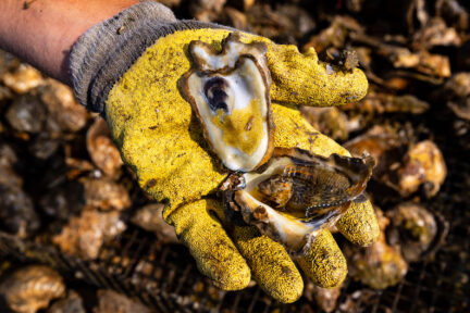
Excess nitrogen, phosphorus and sediment are among the leading causes that contribute to the Bay’s poor water quality. Nitrogen and phosphorus can fuel the growth of algae blooms that lead to low oxygen “dead zones” that negatively impact marine life. Sediment can block sunlight from reaching underwater grasses, suffocating shellfish that rely on them for their habitat.
Best management practices used in backyards, in cities and on farms can reduce the flow of nitrogen, phosphorus and sediment into waterways. Actions taken to decrease pollution from point sources (e.g., wastewater treatment plants) may immediately show detectable changes, but regarding the implementation of best management practices for non-point sources (e.g., runoff that may include fertilizer or chemicals), there is often a time lag in seeing their impact on improving water quality and the health of the Bay.
Importance
By incorporating the best available data into our computer simulations and pollution estimates, the Chesapeake Bay Program can more accurately track our partners’ progress toward their pollution-reducing targets. These data give state agencies and local leaders the science-based information they need to assess their strategies for reducing pollution and tweak if necessary.
Tracking the progress that each jurisdiction is making toward reducing nitrogen, phosphorus and sediment pollution entering not only the Chesapeake Bay, but also their local waterways, helps to improve overall water quality, restore habitats and increase the populations of many plant and animal species. By providing a more accurate picture of pollution in the watershed, the partnership is able to better understand what actions are needed to restore water quality as we work toward an environmentally and economically sustainable Chesapeake Bay watershed.
Quotes
"These results highlight the meaningful progress that Maryland has made with our partners to improve the waterways that sustain the Chesapeake. Through collaboration, dedication and proven strategies, we've achieved reductions across all sources and are nearing our targets. We’re committed to building on this momentum for lasting improvements and a healthier Bay."
- Gregorio Sandi, Vice-Chair, Chesapeake Bay Program Water Quality Goal Implementation Team and Chief, Watershed Restoration Planning Division, Maryland Department of the Environment
“Virginia’s soil and water conservation districts (SWCD) and the producers they work with are dedicated to continually improving practices that enrich our natural resources. Districts across the Commonwealth provide a one-stop shop for farmers to take advantage of technical assistance and tailored funding options offered by District staffers, and to sign-up for state cost-share programs that fund conservation practices. We are proud of the relationships and the trust built with these farms, many dating back decades, and are appreciative for the opportunity to assist the agricultural community while expanding these mutually beneficial partnerships that enhance our lands and waters. With a historic funding opportunity beginning on July 1, 2025, that fully funds the agriculture needs assessment and necessary technical assistance, there is momentum across SWCDs to continue to ramp up their efforts. Our outreach and adoption efforts are evident not only in improved water quality and decreased pollutant loads, but also in stronger community connections”
- Kendall Elaine Tyree, PhD, Executive Director, Virginia Soil and Water Conservation Districts
“It’s my opinion that one of the greatest successes of the Chesapeake Bay Program is its ability to connect with audiences throughout the entire watershed and help them realize the impacts their actions have upon one another. These connections are wide reaching—from educating those downstream on the importance of stormwater catchments, tree canopy cover and working forests, to helping those in the headwaters realize the impacts of their actions on folks living next to the Bay.”
- Jeremy McGill, Assistant State Forester, West Virginia Department of Forestry
Recent Press Releases
Annual Chesapeake Bay Awareness Week celebrates a watershed “Built by Nature, Protected Together”
A mild dead zone is expected for the Chesapeake Bay this summer
Chesapeake Bay Program Provides Final Snapshot of Progress Under 2014 Watershed Agreement