Six key programs that monitor the health of the Chesapeake Bay watershed
Detecting changes over time guides environmental protection
It takes a wealth of monitoring data to protect the lands and waters of the Chesapeake Bay watershed. Monitoring helps us detect changes that take place over time, improve our understanding of the environment and provide support for policy changes that will benefit the Bay. At the Chesapeake Bay Program, we coordinate a system of monitoring networks that track everything from water temperature and pollution loads to changes in the region’s geography. The most extensive monitoring networks fall into six different categories that are all used to paint a collective picture of the estuary’s health.
Tidal monitoring network

The tidal monitoring network began in 1984, a year after the Chesapeake Bay Program was formed. State partners sample the Bay for parameters such as temperature, pH and water clarity at 156 locations within the tidal portion of the Chesapeake Bay (essentially where the water of the Bay meets the land at low and high tide). Then, scientists analyze the data to understand trends in water quality over time. Using the data trends, they produce indicators which help us track the effectiveness of our restoration efforts. For example, the data allow us to assess water quality criteria to meet the legal requirements of the Chesapeake Bay Total Maximum Daily Load (Bay TMDL).
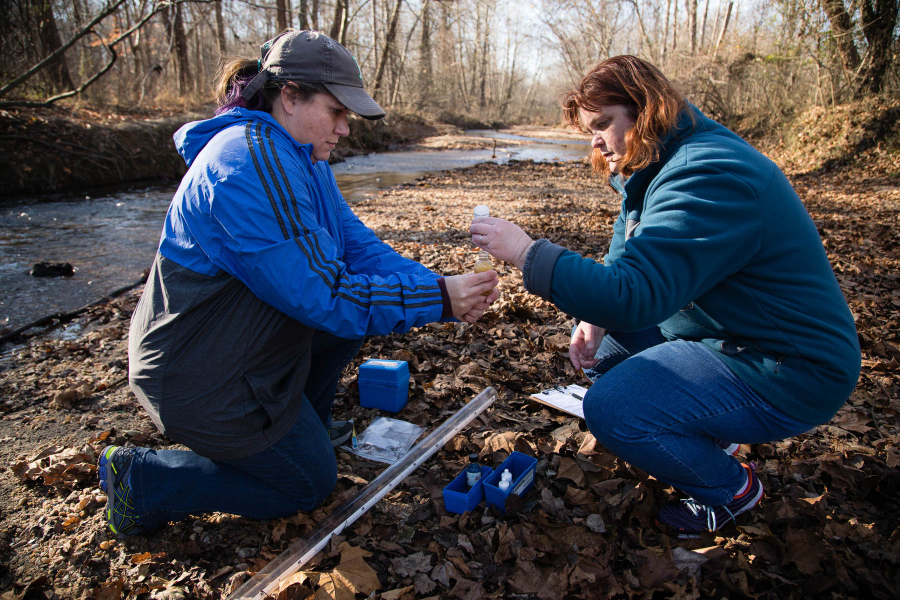
Nontidal monitoring network
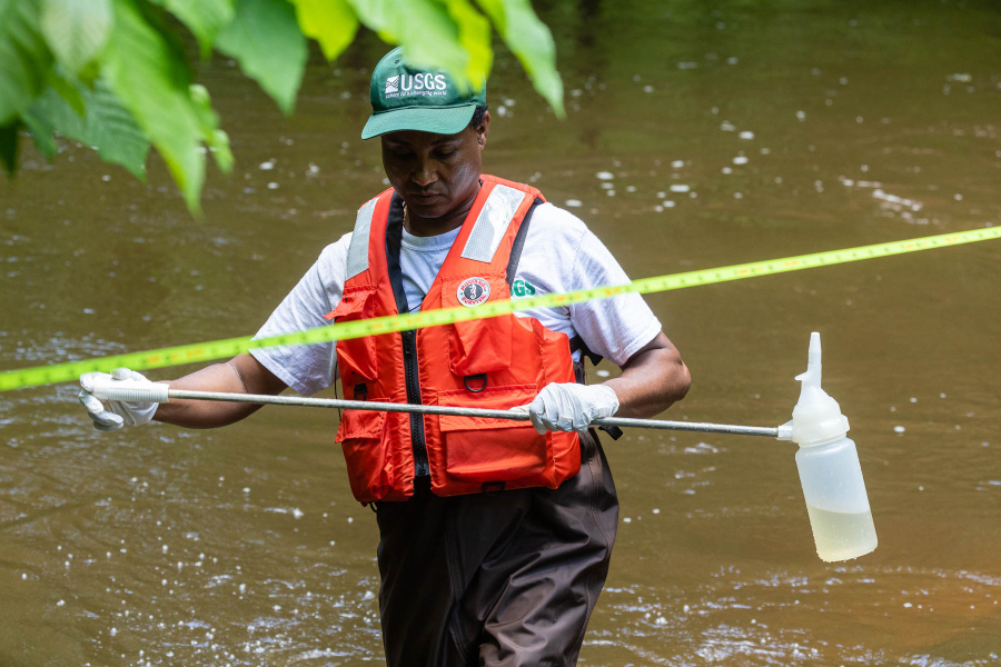
Moving up to the watershed, the nontidal network began in 2004. State partners sample 123 stations one to two times monthly for physical, chemical and biological parameters. This includes nine River Input Monitoring (RIM) stations, located where tributaries feed into the Bay. Scientists analyze the data to understand how nutrients, sediment and streamflow change over time. The data help us understand where the nutrients, sediment and pollutants come from, how much end up in the Bay and where we can have the greatest impact in reducing nutrients, sediment and other pollutants through best management practices.
Submerged Aquatic Vegetation (SAV) monitoring
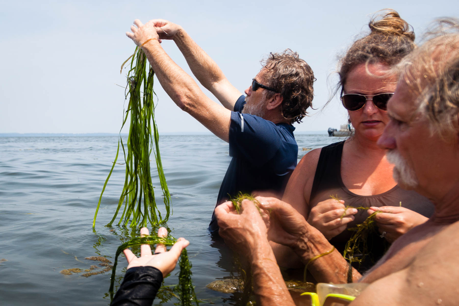
The Chesapeake Bay Program employs a three-tiered approach to monitoring SAV in the Bay that includes aerial surveys, volunteer programs and stationary monitoring sites. Through the Chesapeake Bay-wide Aerial Survey (Tier I), the Virginia Institute for Marine Science monitors SAV acreage and density annually via airplane aerial imaging. Tier II is a volunteer-based program called Chesapeake Bay SAV Watchers that helps us verify the aerial data and identify hyper-local changes in SAV. Finally, the SAV Sentinel Site Program (Tier III) is a collection of sites across the Bay where our partners monitor SAV health and send the data to our monitoring program leads. SAV monitoring is required by law, and the data tells us how close we are to reaching the our goal to restore 185,000 acres of SAV. Without SAV, the water quality and wildlife of the Bay, such as blue crabs and oyster, suffer dramatically.
Tidal benthic macroinvertebrates program

Benthic macroinvertebrates are larval-stage bugs that live at the bottom of streams and rivers. Because these organisms are sensitive to changes in water quality, monitoring them can tell us a lot about how healthy a waterway is. Through the Chesapeake Bay Program, Maryland and Virginia conduct annual monitoring of about 253 sites to sample tidal benthic macroinvertebrates. The data are used to identify trends in benthic condition, help assess progress towards tidal water-quality standards and understand how healthy the water is for vegetation, wildlife and humans.
Land use and land cover monitoring
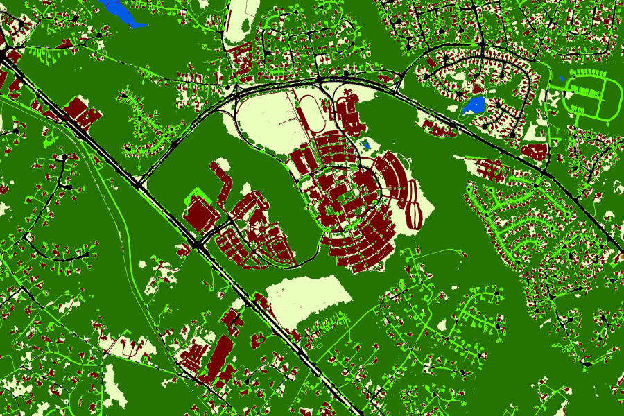
It is just as important to track what’s happening on land as it is in the water. If acres of forest are replaced with housing developments or a parking lot is turned into a park, we need to know that to estimate stressors to the Bay. In order to monitor how land use and land cover change, the Chesapeake Bay Program develops Geographic Information System (GIS) products that use satellite and aerial imagery to determine what’s on the land. These GIS tools allow researchers to understand changes in land use and land cover over time in the watershed, which informs everything from nutrient inputs to urban pollutants to the carbon sequestration of forests.
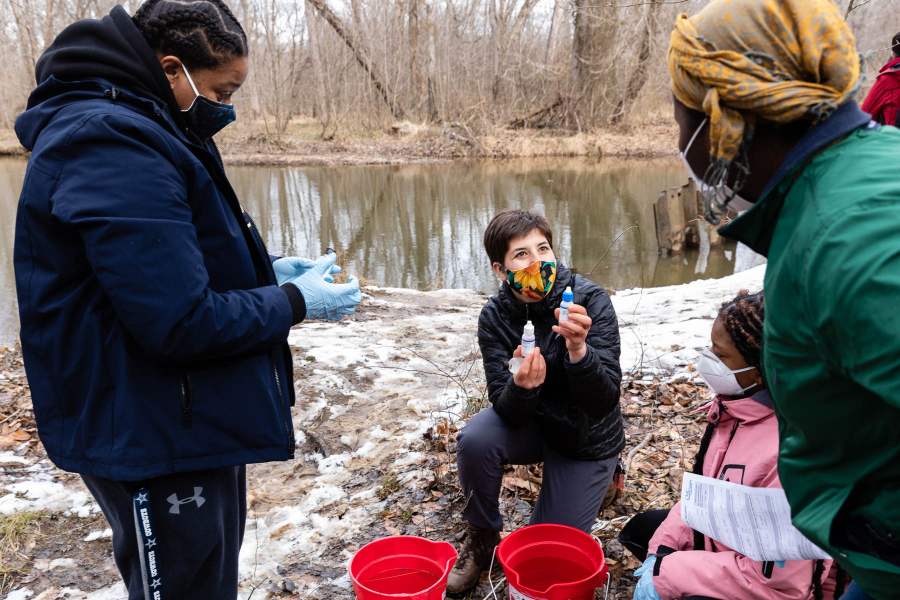
Community science monitoring
Monitoring isn’t something that just scientists do; non-scientists and community members participate too, making key contributions to Chesapeake Bay restoration. Community science is coordinated through the Chesapeake Monitoring Cooperative (CMC), a partnership that supports the integration of nontraditional monitoring data into the Chesapeake Bay Program. The CMC partners with over 80 community science monitoring groups and collects their monitoring data into a central, publicly available data repository called the Chesapeake Data Explorer. The data is used to advocate for local change, inform regional watershed management decisions, improve restoration efforts and for regulatory purposes to assess attainment of the Bay TMDL. The CMC showcases some of these uses through case studies.
As you can see, there are several areas of Chesapeake Bay monitoring that must come together to inform restoration. The Chesapeake Bay watershed includes 64,000 square miles, which is a lot of land and water to monitor. But because of our coordinated efforts, data are collected across the region and used to benefit all partners and stakeholders involved.
Comments
Fantastic work everyone is doing for our planet. Bravo to all involved. Keep it going.
Thank you!
Your comment has been received. Before it can be published, the comment will be reviewed by our team to ensure it adheres with our rules of engagement.
Back to recent stories